Fresh Snow at Roche-A-Cri State Park

Hiking at Roche-A-Cri State Park is a new me. For years I’ve seen signs for it on the highway when driving past it to the Northwoods but never stopped to check it out. I wanted to get my first glimpse of winter and walk through fresh snowfall without driving too far north. 300ft rock outcropping and petroglyphs, how have I never been here?

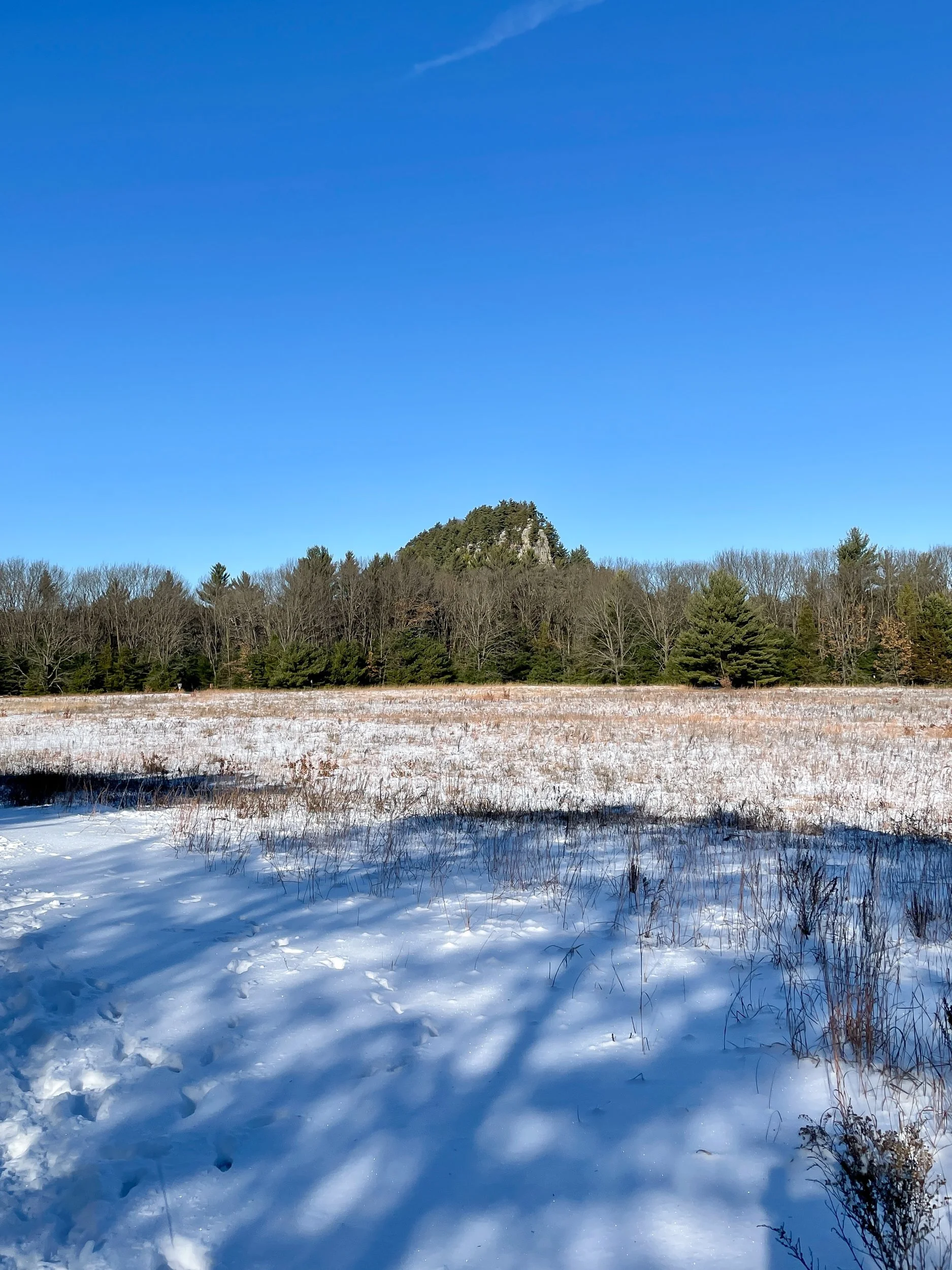
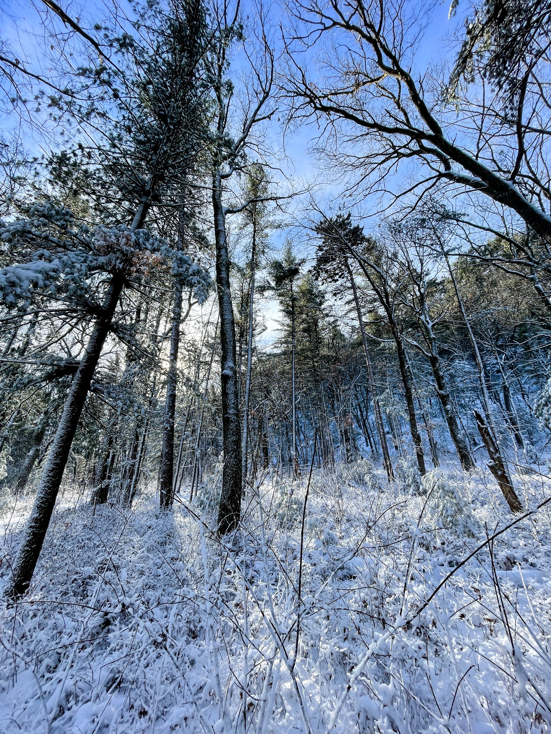
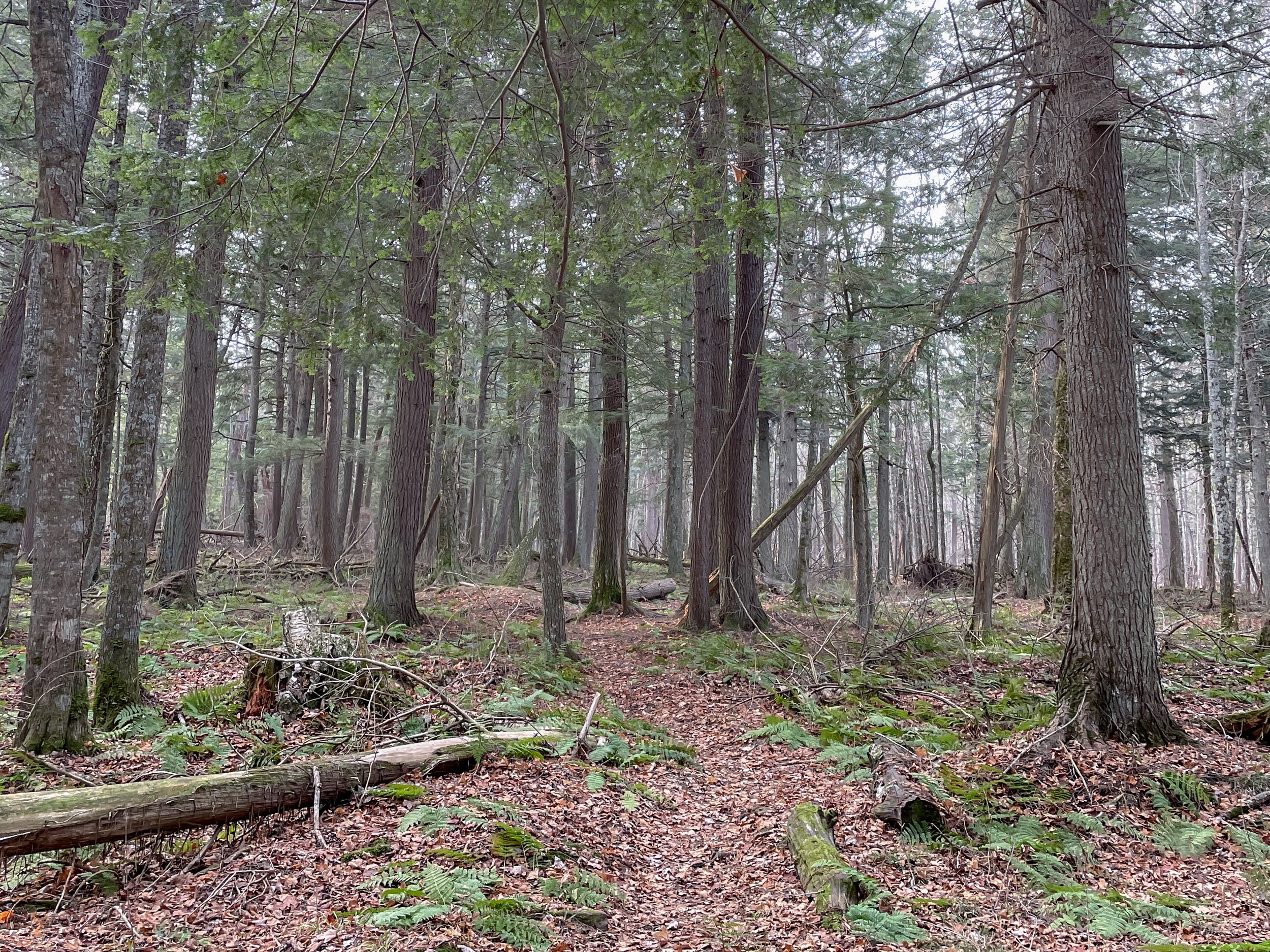
The park has a classic Wisconsin central sands vibe. Pine forests, sandstone rocks, and large grassy prairies. And with the new snow and clear blue sky, it’s a winter paradise. 

The petroglyphs are worn down by the wind but still well worth checking out. From the top of the outcropping, you can see the flat landscape stretch for miles. Dotting the landscape are other rock outcroppings. These were former islands from ancient Lake Wisconsin which covered most of central Wisconsin.

Overall, a pleasant and easy hike, minus the 300 steps up to the top of the rock. 

If you go:

Speakers Cabin Porcupine Mountains

If you want a minimal effort, maximum backwoods fun trip Speaker’s Cabin has you covered.

It’s just under a mile walk to your own private cabin on Lake Superior. You can’t really go wrong with any cabin in the Porkies, but Speakers Cabin, IMO, has the best view, the easiest walk-in, and privacy.

The last time I was here was 6 years ago. For the most part, it’s the same setup. There was a flood of Speaker’s Creek in 2016 which caused erosion along the creek edge. After this, the cabin was moved back 20 feet from the creek to avoid future floods. The great news, the zombie flies I mentioned before have abated significantly. 

This weekend we are here with 2 other friends putting us at the 4 person limit. Speakers is a nice size for 4. Space to cook, a woodstove for heat, a big table, and 4 bunks. Wood for the fire is gathered from around the cabin. Thankfully the last group left us a decent amount of dry wood and we returned the favor for the next group.

Although I've yet to use it, my favorite part is the fire ring overlooking Lake Superior. On a cool night, it would be epic to watch the stars or northern lights around the fire. In the summer, the creek and lake would be great for swimming.

The downside of Speakers is that it’s a bit cut off from the main trail system. It’s possible to hike anywhere in the park from the North Country Trail, the trail running by the cabin, but getting to the heart of the park is a long journey.

On the flip side, Speaker’s Cabin is the closest cabin to the Presque Isle side of the park. Personally, I highly recommend the hike from the cabin to the Presque Isle River and the waterfalls through the Hemlock forest. The trail from the cabin to the falls is lightly traveled through the moody forest. At approximately 5 miles round trip, it's a nice length to pack a picnic and lounge around the falls area.

A Week in the Boundary Waters

I’ve only been back in the US for a few days, but I can’t pass up the chance to jump on my buddy Neal’s Boundary Waters Canoe Area permit. It’s been too long since I was in the midwest’s premier backcountry spot

The thing I love about the BWCA is the limitless combinations to weave together routes through the lakes. It’s this kind of freeform exploration that I’m drawn to. So in this spirit, we set off for a week in the backcountry with no defined plan. 

We set off on a perfect day. Deep blue skies with puffy white clouds lazily floating along. The paddle started with 4 portages in rapid succession. None of them were particularly tough, but loading and unloading that many times gets tiring. 

Our first big lake, Fourtown, is a classic BWCA lake. Rocky points, islands, and lots of campsites. We had our pick of the lot and found a sunny site by 2pm. Early enough to get the hammocks out. I like the speed of this trip already.

The next day we paddled to Gun Lake with a few fishing stops along the way. Another great site surrounded by water on 3 sides. 

We woke up to a misty, rainy day. We debated if we should stay put or move on. After a few extra cups of rainy day coffee, we decided to move. 😆

Turns out it was a good call. The spot we got on Thunder Lake was top-notch. So good we made it a double. Thunder Lake was very quiet. It’s at the end of the line so not many paddlers make their way up there. Both nights we had clear starry skies and heard elk bugling at night. 

After a day off from paddling, we were raring to go. Plus, the wind was picking up and we could feel a storm brewing. Best to get the miles in and find a camp. When we hit Boot Lake the wind was at a full gale. We could see the thunderheads looming in the distance. 

After an exhausting paddle, we got to Fourtown Lake. We grabbed a west-facing spot. Figured it was better to get a view of what was rolling in.

We had just enough time to get the tarp up before the rain started bucketing down. For the next 3+ hours, we rode out the multiple waves of thunderstorms that passed by. It was epic and terrifying. By the time everything blew over, it was well past dark. Finding a spot to pitch our tents that wasn’t a puddle was a challenge. 

The next day was much cooler with bright blue skies. It was our last full day. Since we hardly slept (and survived the thunderstorms!), we decided to stay firmly planted at camp and take full advantage of the day by making good use of our hammocks. 

Links:

Tararua Range Overnight Trip

A few weeks ago we snuck out to the Tararua Range for an overnight trip. I was quickly reminded when backpacking in NZ 1. Bridges are (mostly) a myth 2. The trails go two ways: Straight up or straight down and 3. Moss is everywhere from ground to treetop.

I credit New Zealand for hooking me on backpacking. I grew up backpacking adjacent. Camping, hiking, canoeing, and a few short one-night trips. That all changed when I lived here a decade ago. I quickly fell in love with getting further and further from the car.

We started at the Kiwi Ranch Rd Trailhead, only 45 minutes from downtown Wellington. The Tararua Ranges form a massive forest park with backcountry huts dotting the valleys and ridges. NZ’s backcountry hut program is impressive, featuring over 950 huts. The cost ranges from free to $15/night. 

Our destination was the Tutuwai Hut. We made our way up and over Puffer saddle, descended to Smith’s Creek, and then along the Tauherenikau River. The track was smooth in parts, washed out in others, but we made it to the hut before dark. With decently dry shoes too!

The next day we started with a river crossing and then 2,700 feet up to the summit of Omega. The trail, like many in New Zealand, is impossibly steep. In true kiwi style, there are no switchbacks either. Just gut it out to the top.

From here, it was a long downhill along the Marchant Ridge. At first, the track was densely covered by trees. Toward the end of the ridge, views opened up back towards Wellington. Although we hiked most of the day, we didn't get back to the car after dark. The climb and the trail condition reminded me to adjust my pace expectations when hiking in New Zealand.

Even though it was only a one-night trip, it felt so good to be back in my backpacking birthplace. And my calves ached for two days after.

If you go:

Island Bay New Zealand

Last month we took advantage of the (now closed) travel bubble between Australia and New Zealand. Glad we brought all our stuff, cause we aren’t going back to Australia anytime soon!

We’ve been living in Island Bay, a beautiful neighborhood of Wellington with views over the Cook Straight and the towering mountains of the South Island. We chose this neighborhood because many of our friends live nearby but I’ve fallen in love with the scenery. Raw nature abounds, as it does everywhere in New Zealand. It’s the start of the City to Sea walkway, the Red Rocks Coastal Walk, and the Taputeranga Marine Reserve

We do get some ripping southerlies that feel like our apartment is going to blow away. And it’s a New Zealand winter so it’s damp and cold, inside and outside… but I honestly like this weather. 

Gentle Annie Track

The COVID world tour continues. In April, Australia and New Zealand opened a travel bubble between the two countries. And despite a few outbreaks in Australia, the bubble is holding. 

NZ is hiking heaven. Everywhere you go there are trails to hike. And for the most part, they are all breathtaking. For example, today we drove about an hour outside of Wellington with no plan in mind. Wanting to stretch the legs we picked a random trailhead and started hiking.

There are a lot of entry points to the Tararuas providing access to the windswept ridges and lush valleys. Today we started at the Holdsworth Road End. At the road end, there are spots for car camping and the start of the Gentle Annie Track.

The track heads uphill for 2 miles to aptly named Rocky Lookout, a great place to enjoy snacks and soak in the view. From here we continued onwards to Mountain House Shelter. We were tempted to continue on to the summit of Holdsworth Peak but we started too late for that.

To make it a loop, we descended the River Ridge Track until we reached the beautiful Atiwhakatu Stream. Azure blue water coursed past us as we walked the last two miles back to the car. 

This 7-mile hike was a great reintroduction to New Zealand hiking. It has all the classic kiwi scenery I missed: lush fern-filled forest, crystal clear water, and unspoiled views.

If you go:

100km on the Heysen Trail

Desert backpacking is a new experience for me. Unless you count the brief stretch of the PNT that goes through dry cattle country, my backpacking experience has been in lush forests or alpine mountains with abundant streams. 

The Heysen Trail is a 1200km (750mi) trail that runs from the South Australian coast to the Ikara-Flinders Ranges National Park. Near the northern end is where we start our 100km section hike. And we get to join my brother in law who is thru-hiking approximately half the trail over the next month.

The scenery of the Flinders Ranges is more varied than the barren red Australian dirt I was expecting - mountains, pine forests, rocky ridgelines, and even water in a few glassy pools. It’s winter, which helps make the landscape lusher than in the brutal summer season. In fact, the Heysen Trail is only hikable in the winter because of the extreme summer heat.

Our hike is turning into a real family affair. My inlaws are camping at Wilpena Pound, our first camp spot. This means three things: A free car shuttle, a pre-set-up tent, and (most important) a hot meal waiting for us at the end of the day. This is good because the first day is 34km (21mi) of hiking. 

We start along a flat 4x4 road that stretches into infinity through the red dirt. Around lunch, we leave the plain and crest a ridge with views surrounding mountains. The rocks are some of the oldest on earth stretching back millions of years. The folds show just how much they’ve twisted and shifted over the eons.

Still no sign of Zac as we descend into a lightly forested valley. Around sunset, we arrive at camp. Zac has just beaten us there. There’s enough food here for a dozen people. Perfect. 😋

The next day we start with a walk across the Wilpena Pound. The pound is legendary for its steep sides and only 2 entry points. The circular geography makes navigation tricky. Tales of settlers (and hikers) who entered the pound and never came out are on all the signage. Exiting the pound gives us views over the southern ranges. The rest of the day’s walking is up and down over the haphazard terrain.

The next day we walk along a dry and scrabbly rocky river bed. It’s flat but slow going. We reach the Mayo Hut in the late afternoon. The old stone hut has been lovingly restored by the trail association and makes for a nice place to steep overnight. And no need to pitch the tent!

More riverbed walking. Ugh. But the payoff in the afternoon is worth it. Walking the ridge of Jarvis Hill is a stunning mix of scrambling, trail, and jaw-dropping views. It’s also the end of our walk. We take our time soaking in the red expanse stretching out miles into the distance.

It felt good to sling my pack over my shoulder for the first time since last fall in the Pecos Wilderness. The muscle memory of eat, sleep, hike repeat kicked in and got me fired up for a thru-hike again… someday.

Links:

38km Run Through Freycinet National Park

I’ve dabbled in trail running but never fully dived into it. Over the last couple of months, I’ve had more time (and phenomenal trails) to focus on improving my running.

It was nearing the end of our two months living in Freycinet National Park I wanted to do something big, something that challenged me before we left. Recently I turned 38 and had been mulling over the idea of running 38km (23.6mi) to celebrate. The idea was a bit crazy since my longest run to date was 12km, a run I did in the last few weeks.

I was studying the trail maps to see what hikes I left to do on the peninsula. The only trail left to do was the farthest beach from our house, Bryan's beach. It was exactly a 38km round trip. I had my challenge. 

Up to the night before I wasn’t sure I was going to do it. But when I woke before dawn, I figured it was now or never.

The run started with a climb to the Wineglass Bay lookout. I had done this run several times, but starting in the dark gave my mind something new to focus on. 

The crisp morning air at the top had me feeling good. I flew down the other side of the saddle and across the peninsula to Hazards Beach. The next 1.25 miles was on the beach. Thankfully the sand was hard-packed. Around this point, a switch was flipped in my head. I went from maybe to 100% laser-focused on doing the whole thing. 

I stashed my day pack on Cooks Beach and ran the remaining 3 miles to the end of Bryan’s Beach, my halfway point.

On the return trip, the tide was starting to come in. The sand higher up on the beach was less firm. A slog. Back at my pack, I took a 5-minute break to eat all my snacks. The tide was even higher now on Hazards Beach. My legs were starting to burn.

I took the Hazards Beach Track, a slightly longer way back, to make my route 38km. This track is also more scrabbly with small ups and downs. It was starting to get hard to control my speed on downhills, which was freaking me out a little. But I had done this route many times and thankfully knew the terrain.

The last half mile on this trail stretched on for eternity. It was feeling like days. My lungs were burning along with my legs. Then the meticulously groomed Wineglass Bay Track appeared. All downhill to home. I was glad the parking lot was clear cause I was too exhausted to stop for traffic. 

I got home and collapsed on the floor.

Links:

Mount Graham and Freycinet Summit

19 miles, 4,500 feet of elevation gain, and 2 summits. This is the hike I’ve been most excited about since we moved to Freycinet National Park. Between work and the shorter days, it’s been harder to actually squeeze into the schedule than I’d imagined. 

We headed off on the well-maintained track to Wineglass Bay. The beach is picturesque and the day is stunningly clear. After the beach, we climb up the much less manicured Penisula Track to Mount Graham. Rocks, roots, and a lot of vertical. Or, as I like to think, a lot more fun walking. We climb higher views begin to open up on either side of the peninsula. 

The track enters a long, flat, wet tarn field. Entering the bowl-shaped area feels remote even though I know we’re not all that far from the very popular Wineglass Bay. One more small climb and we tag the summit of Mount Graham. 

After a brief break, we drop down 600 feet into the saddle between the two peaks. Then up another 800 to the summit of Mount Freycinet. It’s slow going. The track up to Freycinet is closer to a scramble. But it’s definitely worth it. The views from the top are incredible.

Claiming the summit of Freycinet took longer than expected and we don’t linger too long at the top. After the scramble back down the trail becomes much more gradual. We had debated going back the way we came to make the hike shorter. But we're glad we didn't. The long way around turns out to be much faster walking. Especially after we get down to sea level at Cooks Beach. From here it is flat walking for the next 5 miles.

On Hardzards Beach we turn around and grab a golden hour view of Mount Freycinet. We even see a wombat running along the beach!

In the fading light, we walk along the Hazards Beach Track eventually returning home in the evening twilight.

Links:

Scrambling Up Mount Parsons

Scrambling around on rocks is one of my favorite ways to hike. Especially, scrambling coupled with a choose your own adventure style route. And this hike you can do without climbing gear or difficult navigation challenges. 

As a disclaimer, this is not an easy hike. If the rocks were wet or frosty your day could go sideways fast. The exposed cliffs along the coast could drop off quite a ways. But on a sunny day, as we had, it made for an excellent time picking our way up the rocks to the top.

At the end of the short Sleepy Bay Track, we scramble up on the rocks and were greeted with a sign that warns us about the dangers of off-trail scrambling. The trail leading into the brush grows fainter and many side spurs appear. From here the fun begins. 

The track climbs about 1,000 feet over ~one mile of climbing. The strategy is to stay on the exposed rocks and avoid getting mired in the brush. We found it was easier to travel closer to the coast. This also gave us sweeping views over the Pacific.

At the summit, we have lunch looking out over Wineglass Bay, Mount Freycinet, and the endless ocean. A multi-day trip known as the Skyline Traverse can be made by continuing on to the summits of Mount Baudin, Mount Dove, and Mount Amos. Maybe another time.  

For us, it was back down more or less the same way we went up, along the steep coastal cliffs. We glance down and see the ocean churning. Dolphins! A pod of them was circling a school of fish. One-by-one they take turns jumping into the middle of the circle and feast. 

If you go: