100km on the Heysen Trail

Desert backpacking is a new experience for me. Unless you count the brief stretch of the PNT that goes through dry cattle country, my backpacking experience has been in lush forests or alpine mountains with abundant streams. 

The Heysen Trail is a 1200km (750mi) trail that runs from the South Australian coast to the Ikara-Flinders Ranges National Park. Near the northern end is where we start our 100km section hike. And we get to join my brother in law who is thru-hiking approximately half the trail over the next month.

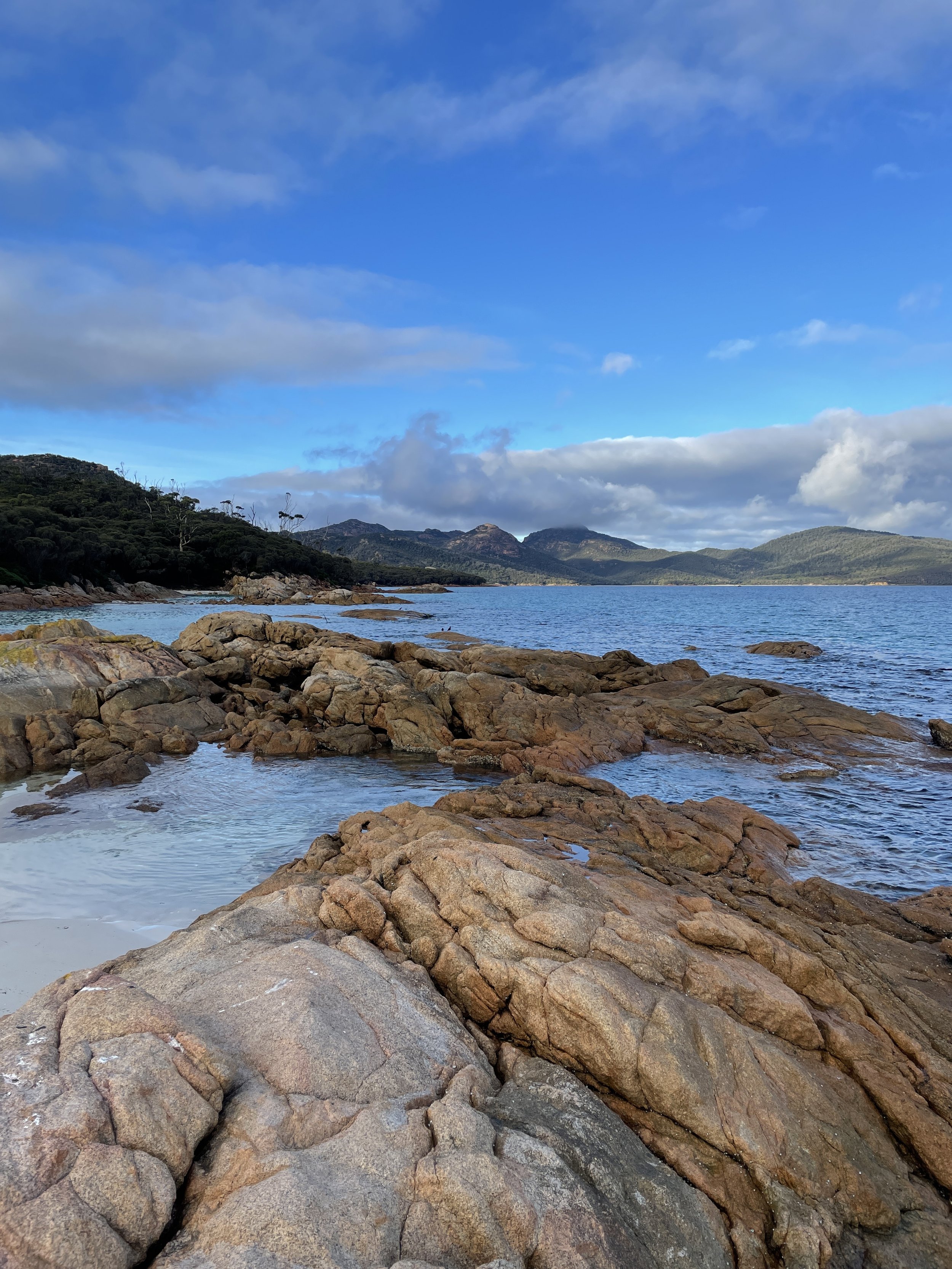
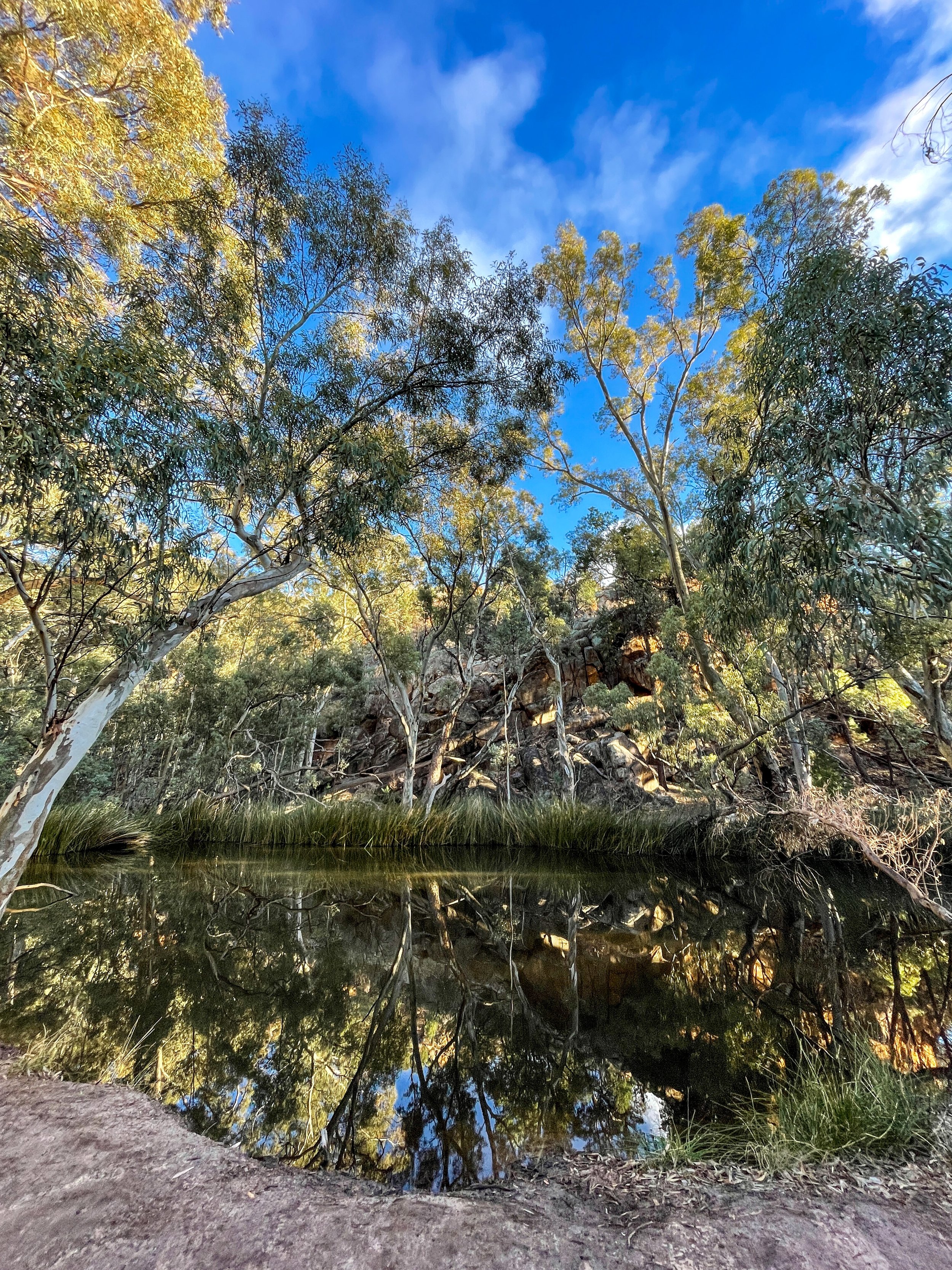
The scenery of the Flinders Ranges is more varied than the barren red Australian dirt I was expecting - mountains, pine forests, rocky ridgelines, and even water in a few glassy pools. It’s winter, which helps make the landscape lusher than in the brutal summer season. In fact, the Heysen Trail is only hikable in the winter because of the extreme summer heat.

Our hike is turning into a real family affair. My inlaws are camping at Wilpena Pound, our first camp spot. This means three things: A free car shuttle, a pre-set-up tent, and (most important) a hot meal waiting for us at the end of the day. This is good because the first day is 34km (21mi) of hiking. 

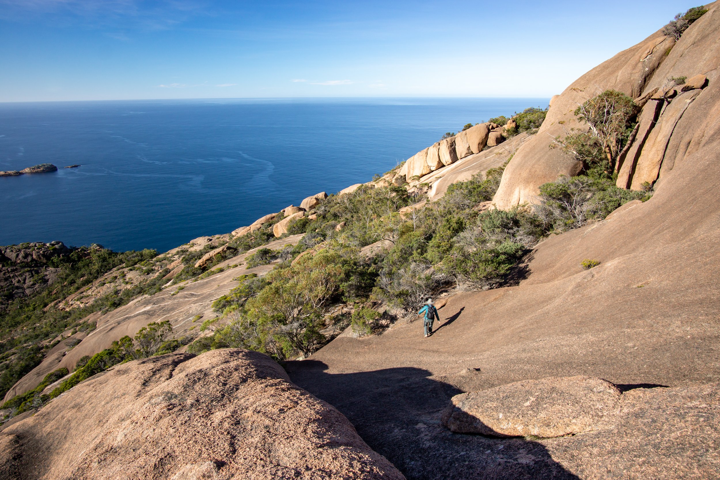
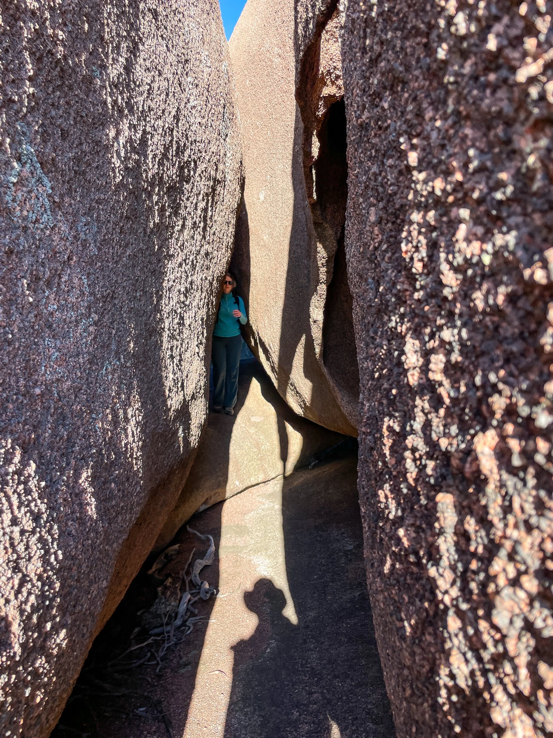
We start along a flat 4x4 road that stretches into infinity through the red dirt. Around lunch, we leave the plain and crest a ridge with views surrounding mountains. The rocks are some of the oldest on earth stretching back millions of years. The folds show just how much they’ve twisted and shifted over the eons.

Still no sign of Zac as we descend into a lightly forested valley. Around sunset, we arrive at camp. Zac has just beaten us there. There’s enough food here for a dozen people. Perfect. 😋

The next day we start with a walk across the Wilpena Pound. The pound is legendary for its steep sides and only 2 entry points. The circular geography makes navigation tricky. Tales of settlers (and hikers) who entered the pound and never came out are on all the signage. Exiting the pound gives us views over the southern ranges. The rest of the day’s walking is up and down over the haphazard terrain.

The next day we walk along a dry and scrabbly rocky river bed. It’s flat but slow going. We reach the Mayo Hut in the late afternoon. The old stone hut has been lovingly restored by the trail association and makes for a nice place to steep overnight. And no need to pitch the tent!

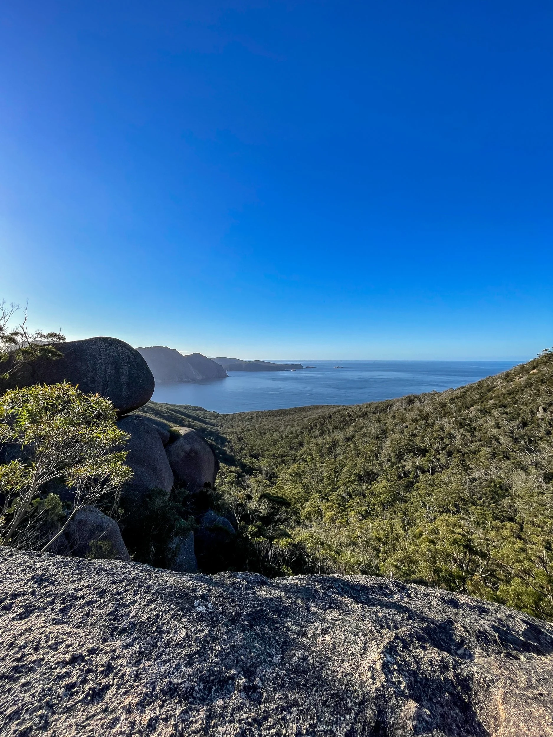
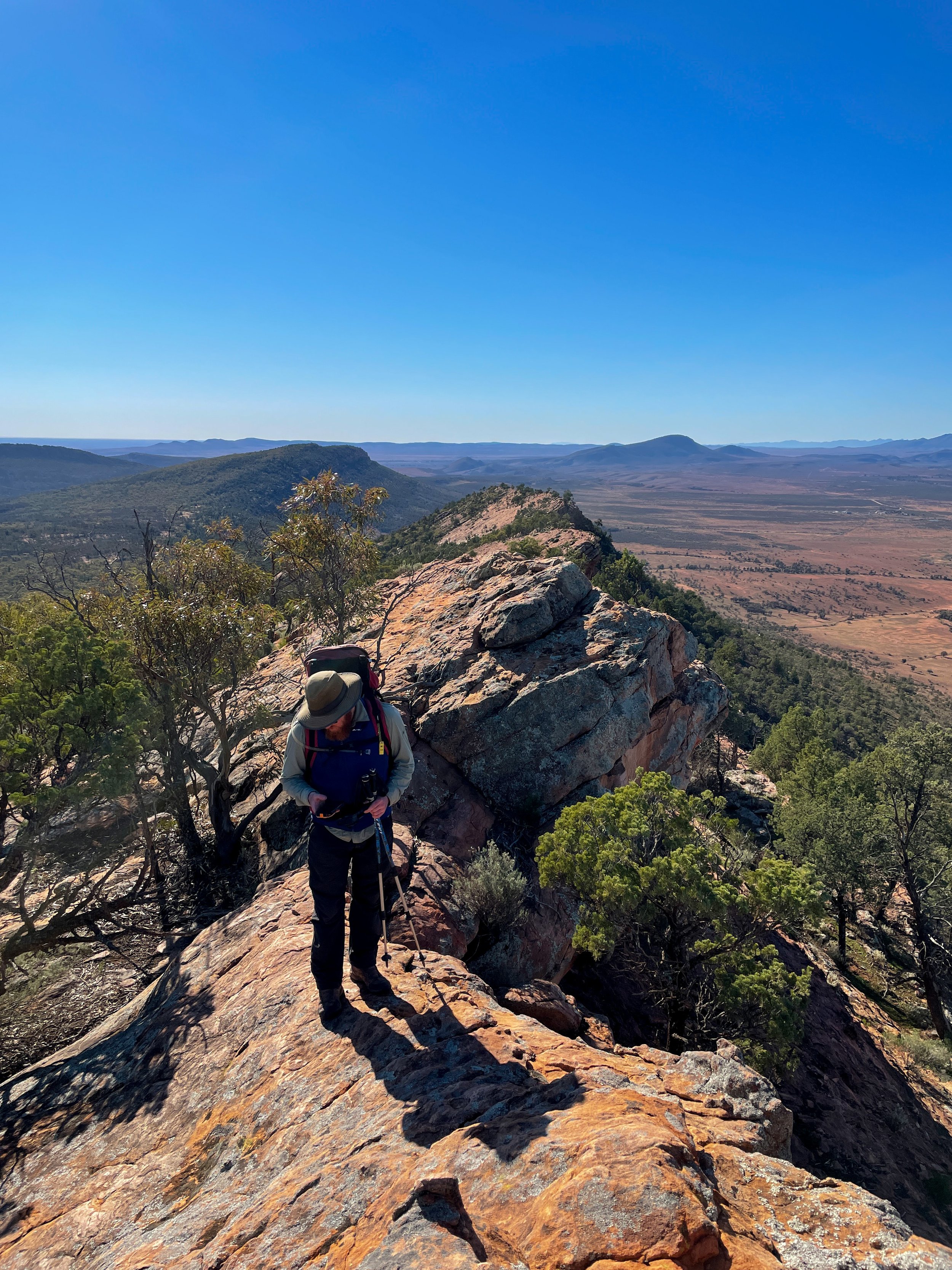
More riverbed walking. Ugh. But the payoff in the afternoon is worth it. Walking the ridge of Jarvis Hill is a stunning mix of scrambling, trail, and jaw-dropping views. It’s also the end of our walk. We take our time soaking in the red expanse stretching out miles into the distance.

It felt good to sling my pack over my shoulder for the first time since last fall in the Pecos Wilderness. The muscle memory of eat, sleep, hike repeat kicked in and got me fired up for a thru-hike again… someday.

Links:

38km Run Through Freycinet National Park

I’ve dabbled in trail running but never fully dived into it. Over the last couple of months, I’ve had more time (and phenomenal trails) to focus on improving my running.

It was nearing the end of our two months living in Freycinet National Park I wanted to do something big, something that challenged me before we left. Recently I turned 38 and had been mulling over the idea of running 38km (23.6mi) to celebrate. The idea was a bit crazy since my longest run to date was 12km, a run I did in the last few weeks.

I was studying the trail maps to see what hikes I left to do on the peninsula. The only trail left to do was the farthest beach from our house, Bryan's beach. It was exactly a 38km round trip. I had my challenge. 

Up to the night before I wasn’t sure I was going to do it. But when I woke before dawn, I figured it was now or never.

The run started with a climb to the Wineglass Bay lookout. I had done this run several times, but starting in the dark gave my mind something new to focus on. 

The crisp morning air at the top had me feeling good. I flew down the other side of the saddle and across the peninsula to Hazards Beach. The next 1.25 miles was on the beach. Thankfully the sand was hard-packed. Around this point, a switch was flipped in my head. I went from maybe to 100% laser-focused on doing the whole thing. 

I stashed my day pack on Cooks Beach and ran the remaining 3 miles to the end of Bryan’s Beach, my halfway point.

On the return trip, the tide was starting to come in. The sand higher up on the beach was less firm. A slog. Back at my pack, I took a 5-minute break to eat all my snacks. The tide was even higher now on Hazards Beach. My legs were starting to burn.

I took the Hazards Beach Track, a slightly longer way back, to make my route 38km. This track is also more scrabbly with small ups and downs. It was starting to get hard to control my speed on downhills, which was freaking me out a little. But I had done this route many times and thankfully knew the terrain.

The last half mile on this trail stretched on for eternity. It was feeling like days. My lungs were burning along with my legs. Then the meticulously groomed Wineglass Bay Track appeared. All downhill to home. I was glad the parking lot was clear cause I was too exhausted to stop for traffic. 

I got home and collapsed on the floor.

Links:

Mount Graham and Freycinet Summit

19 miles, 4,500 feet of elevation gain, and 2 summits. This is the hike I’ve been most excited about since we moved to Freycinet National Park. Between work and the shorter days, it’s been harder to actually squeeze into the schedule than I’d imagined. 

We headed off on the well-maintained track to Wineglass Bay. The beach is picturesque and the day is stunningly clear. After the beach, we climb up the much less manicured Penisula Track to Mount Graham. Rocks, roots, and a lot of vertical. Or, as I like to think, a lot more fun walking. We climb higher views begin to open up on either side of the peninsula. 

The track enters a long, flat, wet tarn field. Entering the bowl-shaped area feels remote even though I know we’re not all that far from the very popular Wineglass Bay. One more small climb and we tag the summit of Mount Graham. 

After a brief break, we drop down 600 feet into the saddle between the two peaks. Then up another 800 to the summit of Mount Freycinet. It’s slow going. The track up to Freycinet is closer to a scramble. But it’s definitely worth it. The views from the top are incredible.

Claiming the summit of Freycinet took longer than expected and we don’t linger too long at the top. After the scramble back down the trail becomes much more gradual. We had debated going back the way we came to make the hike shorter. But we're glad we didn't. The long way around turns out to be much faster walking. Especially after we get down to sea level at Cooks Beach. From here it is flat walking for the next 5 miles.

On Hardzards Beach we turn around and grab a golden hour view of Mount Freycinet. We even see a wombat running along the beach!

In the fading light, we walk along the Hazards Beach Track eventually returning home in the evening twilight.

Links:

Scrambling Up Mount Parsons

Scrambling around on rocks is one of my favorite ways to hike. Especially, scrambling coupled with a choose your own adventure style route. And this hike you can do without climbing gear or difficult navigation challenges. 

As a disclaimer, this is not an easy hike. If the rocks were wet or frosty your day could go sideways fast. The exposed cliffs along the coast could drop off quite a ways. But on a sunny day, as we had, it made for an excellent time picking our way up the rocks to the top.

At the end of the short Sleepy Bay Track, we scramble up on the rocks and were greeted with a sign that warns us about the dangers of off-trail scrambling. The trail leading into the brush grows fainter and many side spurs appear. From here the fun begins. 

The track climbs about 1,000 feet over ~one mile of climbing. The strategy is to stay on the exposed rocks and avoid getting mired in the brush. We found it was easier to travel closer to the coast. This also gave us sweeping views over the Pacific.

At the summit, we have lunch looking out over Wineglass Bay, Mount Freycinet, and the endless ocean. A multi-day trip known as the Skyline Traverse can be made by continuing on to the summits of Mount Baudin, Mount Dove, and Mount Amos. Maybe another time.  

For us, it was back down more or less the same way we went up, along the steep coastal cliffs. We glance down and see the ocean churning. Dolphins! A pod of them was circling a school of fish. One-by-one they take turns jumping into the middle of the circle and feast. 

If you go:

Living In Freycinet National Park

Heading into the slower winter travel season with the international borders still shut we got the idea to look for underused vacation rentals to rent. What we didn’t anticipate was to find one that was INSIDE a national park.

Freycinet National Park is one of the most visited parks in Tasmania. Home to the iconic Wineglass Bay and a network of trails crisscrossing the peninsula, we’ll have plenty to do right out our front door. Or maybe not do. Our rustic vacation home has a deck in the treetops overlooking Coles Bay. An ideal place to sit and relax. 

If living at the trailhead to all the trails on the peninsula isn't enough, there is also a small private beach for residents. And our rental comes with two kayaks. Also, a few small wallabies living outside 😍 Unbelievable. 

Mount Field National Park Weekend

One thing I love about Tasmania (and New Zealand for that matter) is the walking club culture. The vibe is similar to a casual community or church potluck, except with a bunch of hikers. Like the community potluck, the makeup of these groups spans all ages and abilities. 

From my experience, these types of large tent groups are rare in the US. Meetups have a similar openness but are too decentralized to achieve a strong community vibe. More formal groups often are hyper-focused on a specific activity, age group, or cause. Maybe it’s just like that in the midwest though 🤷.

Over the weekend, we went to Mount Field National Park with the Hobart Walking Club. The club has been around since 1929 and has over 800 members. Almost every weekend there is at least one trip planned. Each is organized by a leader and assigned a difficulty rating.

Our trip is an induction weekend for newcomers. There are day hikes each day and the best part is we get to stay at the private club hut near Mt Dobson. The hut has been mostly unchanged since the 1960s due to park regulations limiting the types of repairs the club can do. 

The first day we did an out and back hike to the Tarn Shelf to get views and see the alpine Fagus (beech family) bushes changing color for the autumn. 

The trail starts with a steep climb past the ski area and onto a ridge. After that, it’s a mix of walking on boardwalk and trails with expansive views into the wild, untamed western side of Tasmania. The changing color adds a pop to the scenery but compared to autumn in the deciduous forests of Wisconsin, it’s a bit of a letdown. 

The next day, after an evening cozying up next to the woodstove and talking with the other club members, we set off on a longer hike to Lake Webster & Lake Fenton. A short car shuttle is needed for this hike, but well worth it. These tracks are less traveled, through thick forest and underbrush. The going is slow, but it gives us a chance to chat as we go along.

About 4 miles in we find a pleasant spot to take a break near an open field. All seems fine for the first 5 minutes until an itching sensation hits our feet. Leeches! We pack up and get out there fast. Overall only 1 or 2 bites in the group, nothing like my trip to Ben Nevis years ago.

Near the trailhead, we find a rockier spot (not leech territory) to sit and look over the lake. On the way out of the park, we take the quick 10 min walk to Russell Falls before heading home.

Links:

Urban Hiking Kunanyi / Mt Wellington

Hobart is my favorite city in Australia. I love the weather, I love the walkability. Best of all it has a mountain you can summit from downtown. We didn’t go all the way to the summit of Kunanyi/Mt Wellington but we did manage to do an epic day hike right out the door of our Airbnb.

The first stop with any urban adventure is coffee. Ginger Brown was highly recommended by our friends and did not disappoint. Excellent coffee and cake. Full of caffeine and sugar we start our 2,000ft climb along the Hobart Rivulet. The well-manicured trail slowly gives way to a more rugged and rocky path as we climb higher.

At Junction Cabin we start our loop to see the Octopus Tree, Sphinx Rock, and head past the Lost Freight Cafe - a cafe in a shipping container. The Octopus Tree does look like an Octopus, Sphinx Rock is more of a stretch. The trail is mostly forested but we have occasional views of the city and harbor below. The skies are crystal clear and we can see for miles. 

We head down a fire road on the way downhill, much faster than the climb up. In the evening light wallaby’s start to bounce across the trail. Back in the city, we pass the Cascade Brewery. Tempting but we’re both wiped. The couch sounds a lot better!

If you go:

A Pandemic Escape

Surprise, I’m down under! 

With the ability to work remotely and facing a long, lonely covid winter it seemed like the best option to make it down here for a bonus summer… and maybe longer?

On a bus to an unknown location

Do we tip the army for the concierge service?

It still feels a bit unreal that I’m here. Flights were near impossible to get. Australia is only allowing citizens and their spouses in (I’m lucky to be the latter). Upon arrival, we were whisked away by the army straight into hotel quarantine. They deposited us and our bags into a hotel room and said “see you in two weeks.”

For the next two weeks, the only time we were allowed to open the door to our tiny hotel room was when food was dropped at our door. At first, we tried daily exercises (running laps around the room, pushups) but then abandoned that for laying in bed. Honestly, it was good we both had work to keep us occupied. 

Feeding time at the zoo

Thru-hiker sink laundry skills coming in handy

It seems there is still a world out there

Good views though

Finally, two weeks passed and we were let out into the world. And what a world it is. Australia has had almost no COVID cases for the last 6 months. With the border shut, life has resumed to pre-covid normality. No masks, no distancing. I’m hugging people and going to crowded indoor spaces. It took a while to process and feel ok with this sudden change. But now it seems normal. 

We’ve been staying in North Adelaide, just steps from the parklands, the enormous green spaces that ring Adelaide’s downtown. For a city that (much to my dismay) sprawls in every direction, having abundant nature around is a very welcome sight. 

Inviting…

The River Torrens Linear Trail cuts through the heart of the parklands spanning 35km from the hills to the coast. On the coastal side, it connects to the 70km Coast Park Path. On the hills side, it connects to countless hiking options. For urban walkers it’s a true paradise. 

After a tumultuous 2020, I’m thankful to start 2021 off with a more sedate (and sunny!) atmosphere exploring all these new trails.

Links:

Waterfall Gully & Mt Lofty Hike

Adelaide’s a hot, dry city, but the hills offer respite on a sweltering day. And the aptly named Waterfall Gully offers waterfalls tucked in amongst the greenery. It’s part of a larger trail network that weaves through the Adelaide hills.

For this hike we started at Measday’s Lookout and hiked down the second and first falls. After that we steeply climbed up to Castle Rock and got a nice view down the valley. Then we worked our way past Cleland Wildlife Park and up to the summit of Mt Lofty.

It was hot out and we appreciated grabbing a cold drink at the full service cafe at the Mt Lofty lookout. Sadly the views from the top were hazy. The way down was through shaded gum trees with occasional views of the city and ocean below. Overall a fun 5.75 mile hike and I’d certainly love to come back and hike the other trails in the area.

If you go:

Beach Camping - Innes National Park

It’s the first time we’ve been back in Australia in over 3 years. Amazing how time flies. After a winter chock full of cross country skiing, landing in the summer sun of Australia is a jarring (but very welcome!) switch. Especially since the first thing we’re doing is a family beach camping trip.

South Australia’s beaches are stunning. Given the huge size of the state and small population you don’t have to go very far to get a beach entirely to yourself. Dhilba Guuranda-Innes National Park is roughly 3 hours from Adelaide and loaded with such beaches. And don’t forget the wildlife! There were resident kangaroos at the campground and an emu family roaming the beach.

Camping with the in-laws is a bit different than my normal set up, but we certainly don’t lack for creature comforts.

And if you’re wondering if this car can tow all of this, it can. It did however get a flat tire and the battery died twice. But we eventually made it, set up camp, and had a wonderful few days of exploring the beaches and tide pools.