19 miles, 4,500 feet of elevation gain, and 2 summits. This is the hike I’ve been most excited about since we moved to Freycinet National Park. Between work and the shorter days, it’s been harder to actually squeeze into the schedule than I’d imagined.


We headed off on the well-maintained track to Wineglass Bay. The beach is picturesque and the day is stunningly clear. After the beach, we climb up the much less manicured Penisula Track to Mount Graham. Rocks, roots, and a lot of vertical. Or, as I like to think, a lot more fun walking. We climb higher views begin to open up on either side of the peninsula.
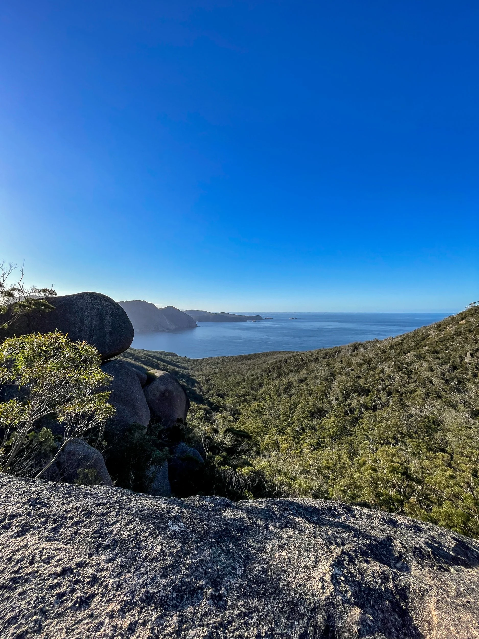

The track enters a long, flat, wet tarn field. Entering the bowl-shaped area feels remote even though I know we’re not all that far from the very popular Wineglass Bay. One more small climb and we tag the summit of Mount Graham.


After a brief break, we drop down 600 feet into the saddle between the two peaks. Then up another 800 to the summit of Mount Freycinet. It’s slow going. The track up to Freycinet is closer to a scramble. But it’s definitely worth it. The views from the top are incredible.


Claiming the summit of Freycinet took longer than expected and we don’t linger too long at the top. After the scramble back down the trail becomes much more gradual. We had debated going back the way we came to make the hike shorter. But we're glad we didn't. The long way around turns out to be much faster walking. Especially after we get down to sea level at Cooks Beach. From here it is flat walking for the next 5 miles.

On Hardzards Beach we turn around and grab a golden hour view of Mount Freycinet. We even see a wombat running along the beach!

In the fading light, we walk along the Hazards Beach Track eventually returning home in the evening twilight.
Links:
Route (Gaia GPS)
Wineglass Bay Trailhead (Google Maps)