Twin Sisters Peak

As winter closes in my range of hiking options shrink. Luckily the front range near Boulder stays snow free longer than the mountains farther west. In Rocky Mountain National Park the Twin Sisters Peak Trail is about 7 miles out and back and gets you to 11,427ft. It is straight up and straight back down. There are a few views along the way but it is mostly through the trees until the last half mile.

Twin Sisters Peak-01260.jpg

There was already snow on the trail and there were a couple dicey spots of ice (yep, I left my microspikes in the car…) on the way up but going slow it was doable. Once we got out of the trees the trail was clear. It was blue skies for miles and the views from the top were stunning.

Twin Sisters Peak-01268.jpg
Twin Sisters Peak-01264.jpg

Mt Bierstadt

My First 14er.

I’m not a peak bagger. I love getting a view but I’d much rather walk a ridgeline than summit something. However, it is rather embarrassing that I’ve lived in Colorado for over a year now and I haven’t hiked a 14er (aka a 14,000 ft mountain).

Mt Bierstadt seemed like a good place to start as it’s considered one of the easier 14ers. We got to the trailhead around 6am and it was already full. It was right around freezing and the boardwalks were slick with frost but once we got moving it was a beautiful clear day for hiking. Little patches of ice crunched under foot where the puddles were the day before.

2018-09-08 Mt Bierstadt-0566.jpg

The trail itself is well trodden and easy going, especially the first mile or so and we made good time. We hit the switchbacks as the sun started peeking over the ridge and then a short section of rock hopping and we were at the top. Snacks and views were consumed. The way down was a breeze. Lots of crowds were heading uphill, glad we got an early start.

2018-09-08 Mt Bierstadt-0612.jpg

The overall elevation gain is ~2,600, which isn’t that different from a lot of day hikes I do but getting up to 14,000ft certainly makes it more challenging. I recorded a trip time of just over 4 hours including a 20 min break at the top, 7.25 miles total.

If you go:

Guanella Pass TH

Trail Map: Caltopo / Gaia

Lily Mountain - Short Hike, Long Views

Blog 2018-04 Lily Mt-2232.jpg
Blog 2018-04 Lily Mt-2237.jpg

Lily Mountain is short but packs a punch. The trail itself is just under 2 miles each way with ~1,100ft of elevation gain, but the sweeping views from the top are some of the best, looking directly into Rocky Mountain National Park. It’s a great place to go for a short hike or, in my case, maximum reward for minimum effort for an out of state visitor.

Finding the trailhead can be a little bit of a challenge as it’s not really marked and there is no parking area. Use your GPS or just look for the cars parked off the side of the road near the start of the trail. The hike is mostly straightforward with a little bit of off-trail scrambling at the end to get to the official top. It’s a great place to hang out, eat some lunch or snacks and head back down to the parking area.

If you go:

Bear Peak Loop

We’ve been settling into Boulder the over last week getting to know the lay of the land. Now that we’re (mostly) moved in I’ve been turning my gaze to hiking. There are so many amazing trails right in the city, I can bike to so many trailheads! It’s a bit hard to know where to start so we figured it made sense to start with one of the top rated trails in the Flatirons, Bear Peak, and get some good views of our new city.

We started the trail from NCAR but you could start this trail from many of the trailheads in Boulder, everything is connected by trail. From the parking lot we made our way to the Mesa Trail via Table Mountain. Once on the Mesa trail we headed about .7 miles to the Fern Canyon Trail. We did the loop in this direction because it gets most of the climbing out of the way at the start and provides a more gradual downhill for the last ⅔ of the hike. I prefer steep uphills and gradual downhills as it’s easier on my knees but if you’re the opposite you can do the loop in the other direction. Yay loop trails.

Wow, the Fern Canyon Trail is steep. Since it’s in the canyon it’s about 10 degrees cooler, a big plus since you’ll be working up a sweat on this one. Once you get to the small saddle the last .4 miles to Bear Peak are a mix of steep trail and, especially at the end, some scrambling to reach the peak. Enjoy the view, you’re ~3,000ft above Boulder. Due to all the wildfire activity in the western US it was hazy towards the divide but we still had good views of the city below.

BLOG 2017-08-30 Bear Peak Loop-09371.jpg
BLOG 2017-08-30 Bear Peak Loop-09363.jpg
BLOG 2017-08-30 Bear Peak Loop-09375.jpg

On the way down we took the Bear Peak West Ridge trail which slowly works its way downhill with good views west to the divide. After 1.7 miles we turned on the Bear Canyon Trail and took this all the way down the canyon, crossing over the Mesa Trail we were on before, and took the short connector trail back up to the NCAR parking lot.

If you go:

Leech Attack on Ben Nevis

It was a cold misty morning when a group of us decided to drive up to summit Ben Nevis. The “road” where the trailhead starts can scarcely be called that. More like an overgrown logging track that is just wide enough for a 4WD vehicle. There’s not even a real place to pull off, so if another party would come in they’d likely block you in.

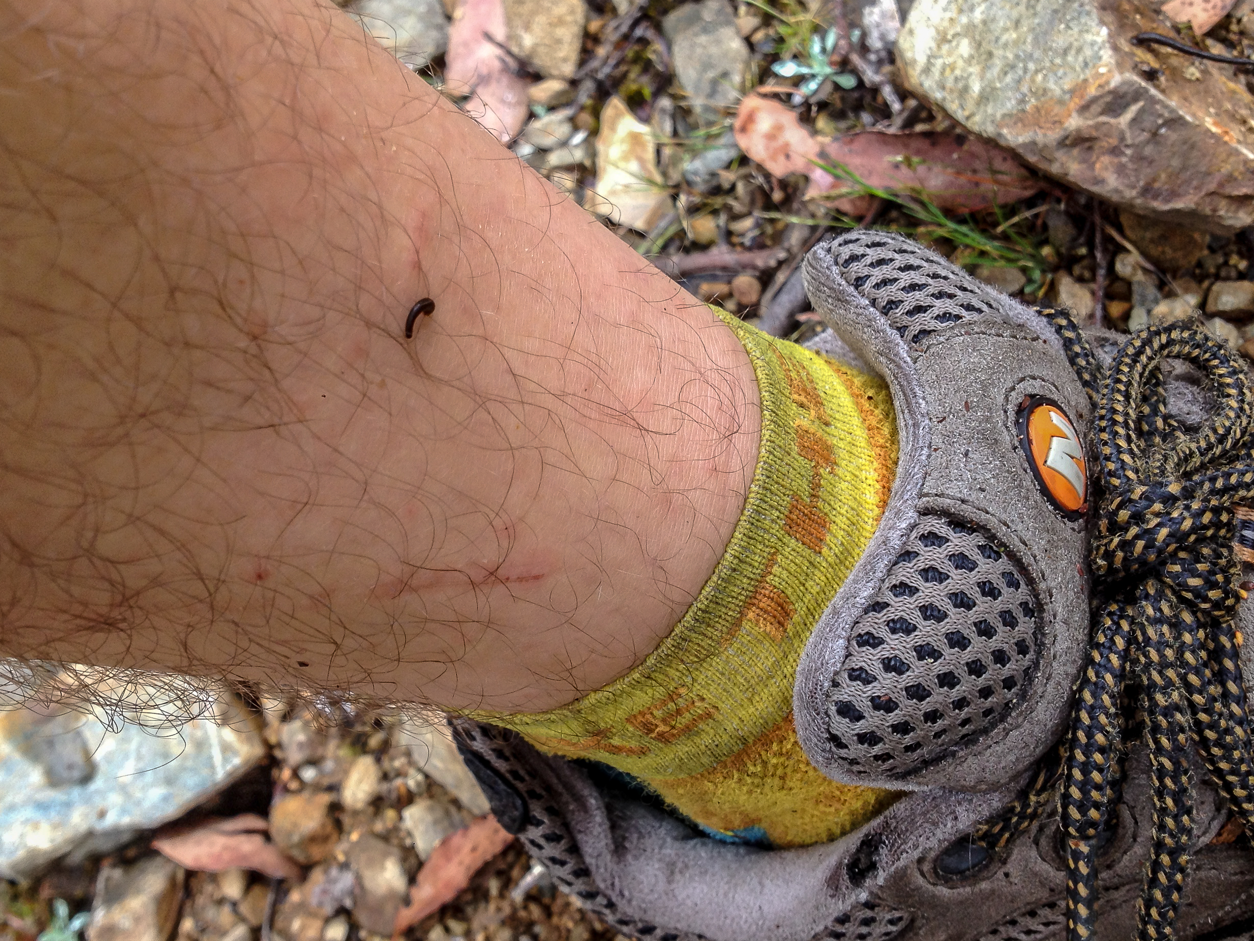
Just as we’re approaching the trailhead our friend who organized the trip casually mentions that this area is in fact known to have “some” leeches. Yay. But I’m told they only come out when it’s misty and wet -- great…

15 minutes in to the hike my ankles start itching. Weird, but i’ll keep walking. 10 minutes later they are really itching. I look down (I shouldn’t have looked down), there are at least a dozen leeches on each ankle. I frantically start ripping them off (the itching increases by factor of 10). I’m told not to stop as more will just get on me. Sound advice as the ground is literally MOVING with leeches. Holy. Shit. The “good” news is that if we walk fast and get out of the forest there will be no leeches on the rocky top. I walk fast.

Blog 2017-01 Ben Nevis-6235.jpg
Blog 2017-01 Ben Nevis-6237.jpg

We break through the forest line and everyone stops to remove the leeches the second we get onto the rocks and we continue the misty march to the top. There are no views but walking through the mist above the tree-line has its own eerie beauty which I quite enjoy. When we reach the top we take off our shoes, ring out our wet socks and remove a few leech stragglers.

Blog 2017-01 Ben Nevis-4499.jpg

We hang out at the top hoping for a break in the clouds but one never comes. As the mist comes and goes we get views below us and it’s surprising how high we climbed from the tree-line. Heading back down the mist get thicker and it takes a second to locate the saddle we climbed up on. Once we find our trail it’s every person for themselves as we race through the leech infested forest.

I’ve never been so happy to see the car.

If you dare to go:

Cradle Mountain Summit

I’ve wanted to summit Cradle Mt for the last 8 years (ever since my in-laws moved to Tasmania) but every time we visit it’s either 1. Winter or 2. Storming. Finally this time around we have a good weather window.

It’s peak season so we had to take the shuttle in. The good news is that this allowed us to start and end from different trailheads.

Blog 2016-12 Cradle Mt-4297.jpg

We got dropped off at the Ronny Creek trailhead and started walking on the Overland Track (sidenote: someday I want to do the full overland track, 51 miles to Lake St Clair to the south). It’s late December but it was a chilly start as the trail steadily climbed up to Marion’s Lookout. At one point I saw a snake on the trail, probably deadly, this country is horrifying.

From there the trail heads to Kitchen Hut and shortly after we turned onto to the Summit Track. All of these trails are very well travelled and heavily used. After some steep climbing the trail turns into scrambling for the rest of the way to the top. We had a blast on this part and some sections are fairly challenging. There is a main route most hikers take but at points it becomes a bit of a choose your own adventure -- awesome!

Blog 2016-12 Cradle Mt-6130.jpg
Blog 2016-12 Cradle Mt-4314.jpg

The views from the top are stunning, much of Tassie can be seen, mountains in every direction.

Blog 2016-12 Cradle Mt-4313.jpg

The way down is nitpicky. Scrambling down, IMO, is much freakier than going up. I wouldn’t want to be going down this in rain let alone ice or snow.

Blog 2016-12 Cradle Mt-4349.jpg

We headed back via Kitchen Hut and Marion’s Lookout and then took the Wombat Track back to Dove Lake to grab the shuttle back to the park entrance. If you have the time I’d recommended taking Face Track at Kitchen Hut to the Lake Rodway Track and out that way. Overall it’s longer but you get to stay high for the views for more of the hike.