Berg Lake Trail & Mt Robson

Berg Lake trail. Wow, possibly one of the most scenic trails I’ve done. For 20km / 12.5mi each way the trail has it all: forest, lakes, mountains, glaciers and views.

berglake-08640.jpg
berglake-08576.jpg

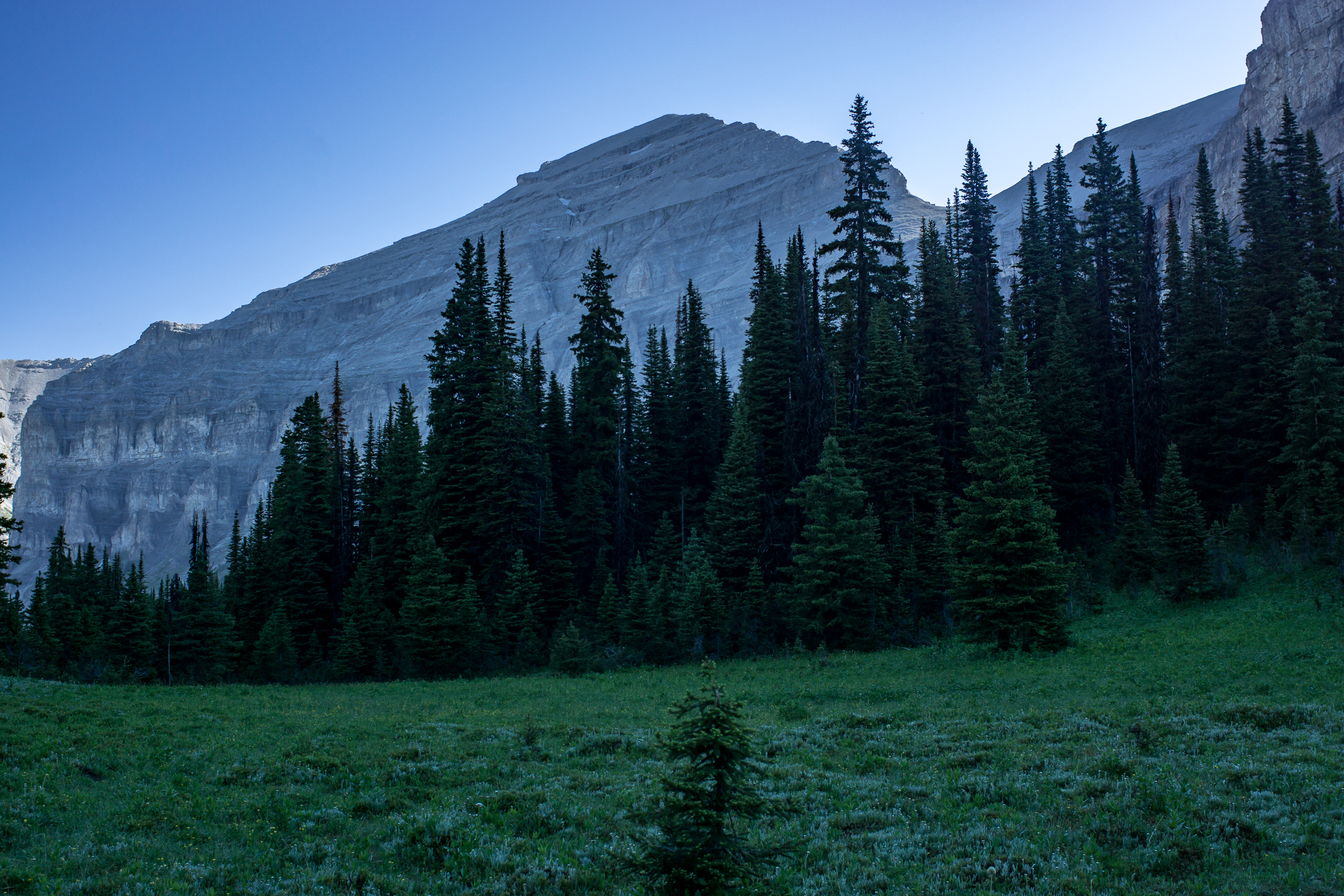
Day 1 we get an early start heading to the Robson Pass campground, the furthest from the trailhead at 20km / 12.5mi. The hike up begins along the brooding Robson river through thick forest with glimpses of waterfall tumbling off the cliffs above. After 11km / 7mi the trail ascends steeply past Emperor Falls and pops out on Berg Lake and superb alpine views.

berglake-08531.jpg
berglake-08597.jpg

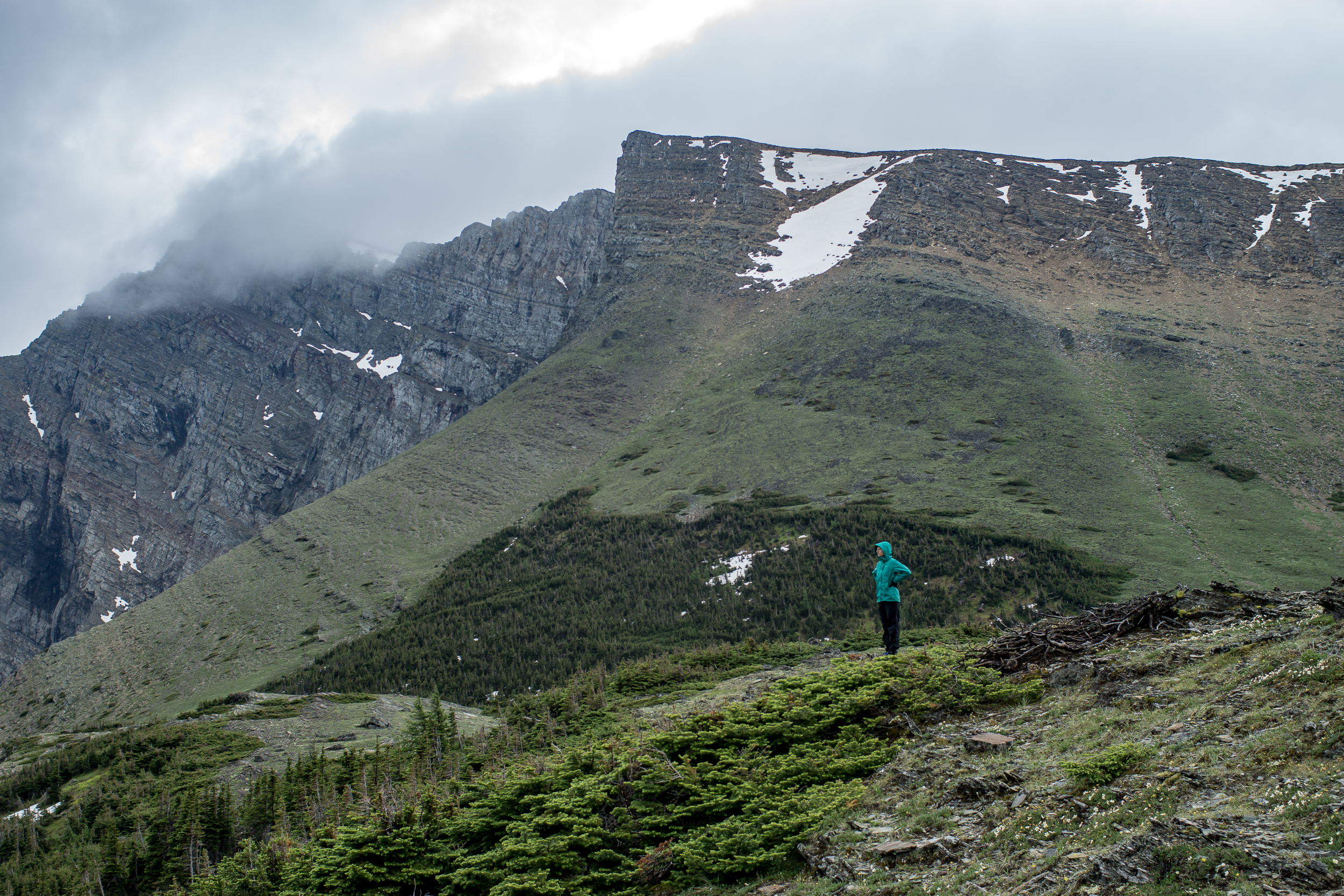
Day 2 is spent exploring the meadows around Snowbird Pass and taking in the views of the permanent snow field at the pass. The trail is easy to follow and winds around Mt Robson at the start and then to the pass. It starts to get steep closer to the pass but it’s 100% worth going all the way to the end to get the views of the snowfield.

berglake-08743.jpg
berglake-190.jpg

Getting back to camp I realize my shoes have a chunk missing out of them. I try my hand at fixing them with some super glue and a piece of our pot-scraper, aka Walgreens rewards card. We’ll see how long it lasts.

berglake-08662.jpg

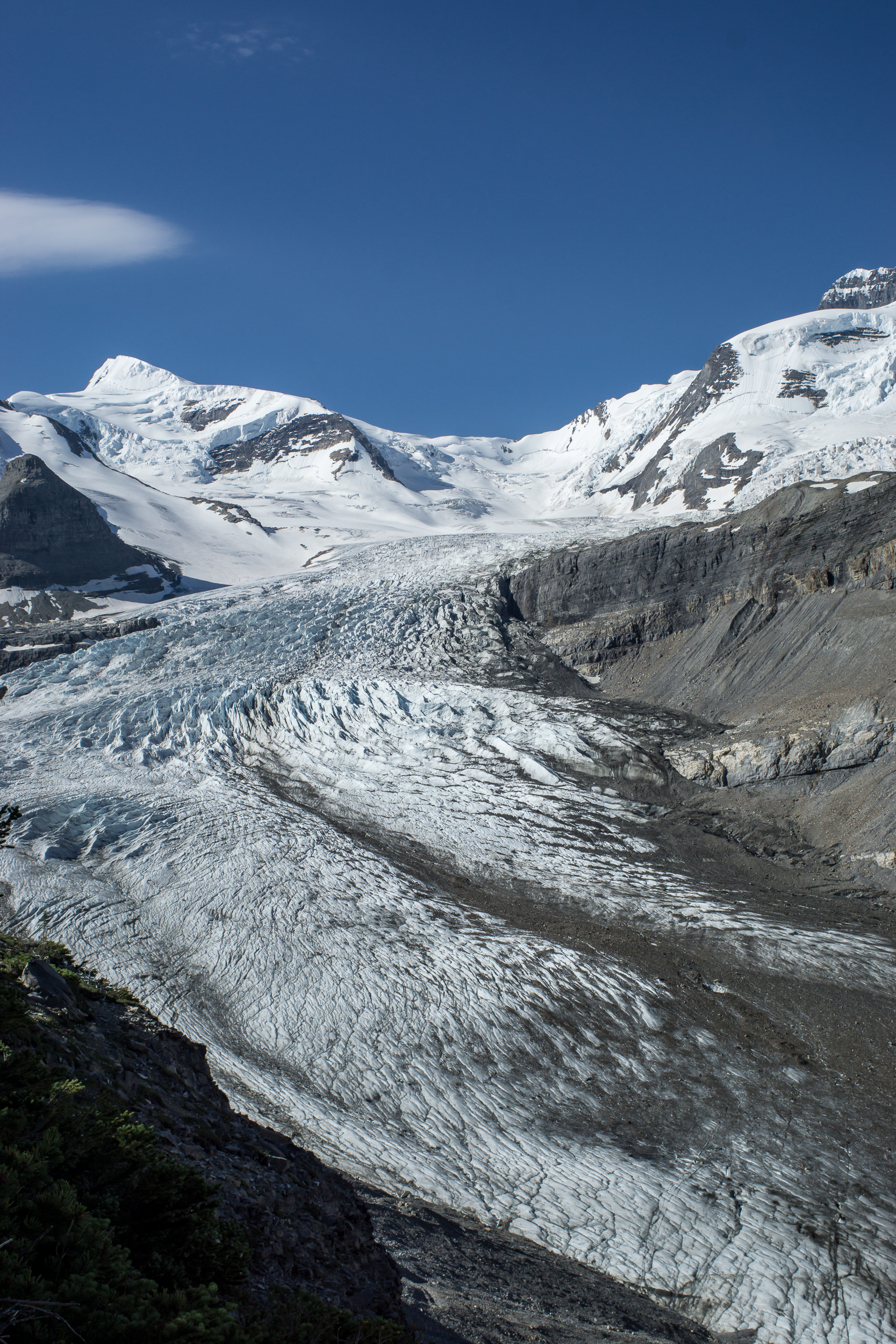
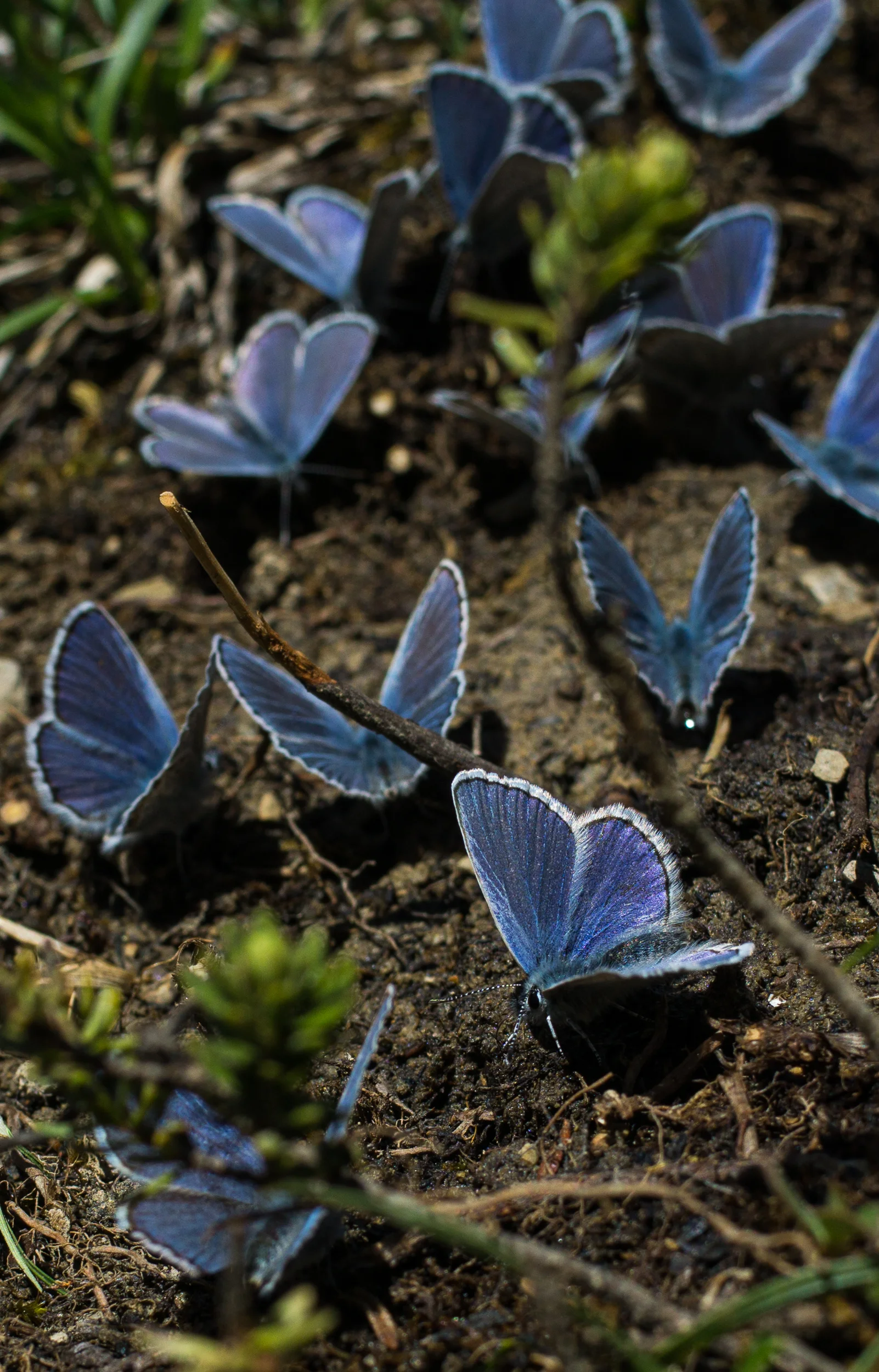
Day 3 we hike via Toboggan Falls and the Hargreaves Glacier before heading back down the trail to Kinney Lake. It’s windy and we don’t spend a lot of time at the top. At the lake a kaleidoscope of butterflies (yes, that’s the real collective noun!) watches us make dinner in the sun.

berglake-08753.jpg
berglake-08567.jpg

Day 4 is a short, 6.5 km / 4 mi, walk back through the forest to the trailhead. Today is considerably more smokey than the past 3 days. Looks like we got the timing right for the views. Back to Jasper, a great little town much more chill and down to earth than Banff.

If you go

Great Divide Trail - Fire, Bears & Section B

Fire has hit the GDT in a big way. At present we are in Banff and a big chunk of section C (near Banff is closed).

We saw signs that fire season was coming all along the way. It hasn’t rained a drop since our first day (2 weeks ago) and it’s been hot, like 30C hot, on most days. Along some dirt roads the fire service has set up outposts and are just sitting and waiting for fires to break out.

GDT B-08415.jpg

We depart Coleman and start section B with the forecast calling for 7 days of sunny and hot weather. In Coleman we stayed at A Safe Haven B&B and the hosts, Alannah and Dan, are among the few trail angels on the GDT. They offer discounts to hikers and even load us up with food as we head out. We were so busy before we left we completely forgot to call and book (or even state our intentions) to stay with them. I felt pretty sheepish showing up at their door unannounced but they didn’t bat an eye and welcomed us into their home.

We end up grabbing a hitch out of town to the Dutch Creek Provincial Recreation Area. This goes against the thru hiker ethos but after reading trail reports about the section before Tornado Mountain we decide that hitching saves us a day (we are on a tight schedule). It gets us to the Dutch Creek CG in 29km vs 64km on the primary route.  

Dutch Creek Campground is a beautiful spot nestled near a boulder field just before Tornado Pass. This early in the season it’s fairly marshy and it takes a bit to find a dry site. In the night I’m awoken by the sound of rocks being tossed around in the boulder field. It’s a near a full moon and fairly light out. I don’t see anything but I do remember seeing a decent amount of bear poop on the trail up. I toss and turn for the rest of the night unable to sleep thinking about what might be flipping the rocks...

The next day we head up and over Tornado Pass, made more challenging due to an avalanche over the trail. The trail up is steep shale, definitely our hardest climb of the trail thus far.

After last night’s sleepless night I’m definitely a bit freaked to sleep out in the backcountry again. The Oldman River Road is only 3.2km off trail and there is more car camping, campgrounds etc along the road. It’s illogical to think it’s safer around car campers but it comforts me and we choose to camp along the road.

GDT B-08403.jpg
GDT B-132.jpg

The next day we hear from campers that there are fires burning in British Columbia and possibly close to the GDT itself.

Which brings us back to Banff, right now trying to figure out the game plan. Given our short window of time and that we weren’t planning on doing the whole GDT we’re torn on whether we try to keep going somehow or switch up the plan. We still have about 3 weeks before we need to head home.

For now we wait.

Great Divide Trail Section A

We begin our adventure on the GDT with a climb from Waterton to Alderson Lake, our first camp. It’s only 7.5 km (4mi) but it’s a nice way to ease into the trail.

GDT A-08173.jpg

A contentious issue before we started the trip was the matter of camp shoes. I was staunchly against, K was in favor of a pair of cheap flip flops (7 ounces, insane!). It’s day 1 and we come back from cooking dinner to a missing flip flop. We hunt for it with no luck. I’m blamed. I swear it was a marmot (it was, honest).

GDT A-08186.jpg

It rains overnight and we wake up to a misty morning. The trail to Carthew Lakes is clear until just before the last steep climb to the lake, here we encounter a ~6ish foot snow wall. We make it over by cutting in foot and hand holds and slowly making our way up. At the top we see the lake and tons of marmots hanging out on the rocks (which one of you is currently lining your burrow with a comfy stolen flip flop?). When we get to Cathrew Summit the fog has lifted and the views are jaw dropping. We are definitely take an early lunch break here.

GDT A-08191.jpg
gdt pano.jpg

At Cameron Lake the sun is shining and it’s packed. We just left Waterton yesterday but it feels weird to see this many people especially since we only saw one other camper last night. From here we head down the road to the Akamina Trail and the Akamina Creek Campground. We make it to the campground by 4pm and enjoy the rest of the sunny day relaxing near the creek.

GDT A-08202.jpg

Day 3 we head back out to the road and take it to the Tamarack Trailhead. We debated taking the Mt. Rowe-Sage Pass alt but it’s only day 3, let’s not get ahead of ourselves. The trail up is mostly shaded, good cause it’s getting warm, and the wildflowers are everywhere. About 5km (3mi) from the start of the trail we reach an open meadow before we start up the ridge. From here the ridge looks impressive, and it is, there is 1,500ft of elevation gain in the next 1.5 miles.

GDT A-08249.jpg

Walking up to the ridge we are going over snow patches, most are fine, a few are a little steep and deeper than I’d like. What makes me more nervous is the snow above us, it looks stable but it’s overhanging the edge. We hurry past this part of the bowl and just before the apex of Lineham Ridge there is one last lick of snow to cross. The ridge comes to a point and the trail goes up and over. To our left it’s steeper with deeper snow (see: slide back down the 1,500 ft we walked up), to our right a ~700ft drop off (see: death). There’s a big bear paw print in the snow, and the view past it is obstructed by a small rock pile we have to cross. From looking at either side of the snow in the small dip before the rockpile I come to the conclusion that it’s probably not a snow bridge. K really doesn’t like the “probably” qualifier. We brave it over and thankfully it’s not as bad as it looked once we get on it. Once we’re on the other side the entire ridge down is snow free with views for miles.

GDT A-08262.jpg
GDT A-08256.jpg

The Tamarack Trail follows the northeast facing side of the valley and there is still snow (and snowmelt) here making it a slow slushy walk. We come across many bear prints and fresh-ish scat on this section of trail. I’m glad Lone Lake, our destination, is in another valley.

GDT Section A-078.jpg

Day 4 and another day of clear blue skies. I didn’t get very cold last night so I’m expecting today’s going to be a hot one. We head out toward Twin Lakes, no one else in sight. The trail into Twin Lakes is the same as into Lone Lake, snow covered and some postholing is required to get down. When we get to Twin Lake we stop and have our first major trail discussion of the trip.

GDT A-08283.jpg

After yesterday's freaky snow experience on Lineham Ridge we’re not sure what the GDT primary route over Sage Pass will be like. We don’t have ice axes for snow travel and we know the next 2 days involve some very steep ridges. Could be dicey. The alternative is to take the Twin Lakes Trail down to (I think) the Avion Ridge Trail. Once the trail hits the border of the park we should be able to take an old fire road down to the South Castle River and then follow the road/ATV trails out to the road and rejoin the GDT at A31/Syncline Mountain Trail. It’s a big detour and it’s skips some great ridge walking, but much less risky.

GDT A-08325.jpg

In the end we take the detour, I’d hate to come across a situation feel “obligated” to continue on a dangerous path. It’s a bummer but the route ends up being a fun journey through the castle river valley. Once we are at the edge of the park the trail stops but the fire road is obvious the whole way down. There are a few blowdowns but nothing too intense. When the trail levels out there are sections of brushy willows bushes over the trail, annoying more than difficult, but otherwise a clear trail. We camp about ⅓ of the way down the valley.

GDT A-08380.jpg
GDT A-08319.jpg
GDT A-08375.jpg

Day 5 is mostly walking down the rest of the Castle River valley and then out to the 774 road. The walking goes fast, as we get closer to the developed road the trail changes to ATV to gravel road. We spend part of the afternoon “swimming” (more like running in and running out of the water before we freeze) in the Castle River, later we find an old campground near the river to stop for the night. The walking was easy, mentally it was tougher thinking about the ridge section we were skipping.

Day 6 We begin the day by hitting the 100km mark of the trail (although with our detour i’m not sure how far we’ve actually walked), then immediately onto a cutline straight up 1,000ft. After that we’re mostly on ATV roads for the rest of the day until we get to Willloughby Ridge and start to climb again. It’s windy and we end up camping on the east side of the ridge instead of the ridge itself to provide some shelter. The only flat-ish spot is the trail itself which is also covered with bear track (black bear I think/hope). Yikes.

Day 7 Walking Willloughby Ridge is beautiful and the weather is calm. We’re not in the mountains but the views of the mountains from here are stunning. After the ridge it’s 16km of ATV trails into Coleman. Section A complete!

Links: