20 Hour Getaway

Its a busy Labor Day weekend for me but I have the itch to camp. 

After shooting photos for a client in the morning i grabb my pack and hastily shove my gear in. Luckily, in the spring I got on kick making a bunch of meals in anticipation of hiking season. I grab one of those and some oats and hop in the car. An hour later I’m at the Moffat Tunnel trailhead ready to hit the trail. The beauty of living in Boulder.

Blog Crater Lakes-0545.jpg

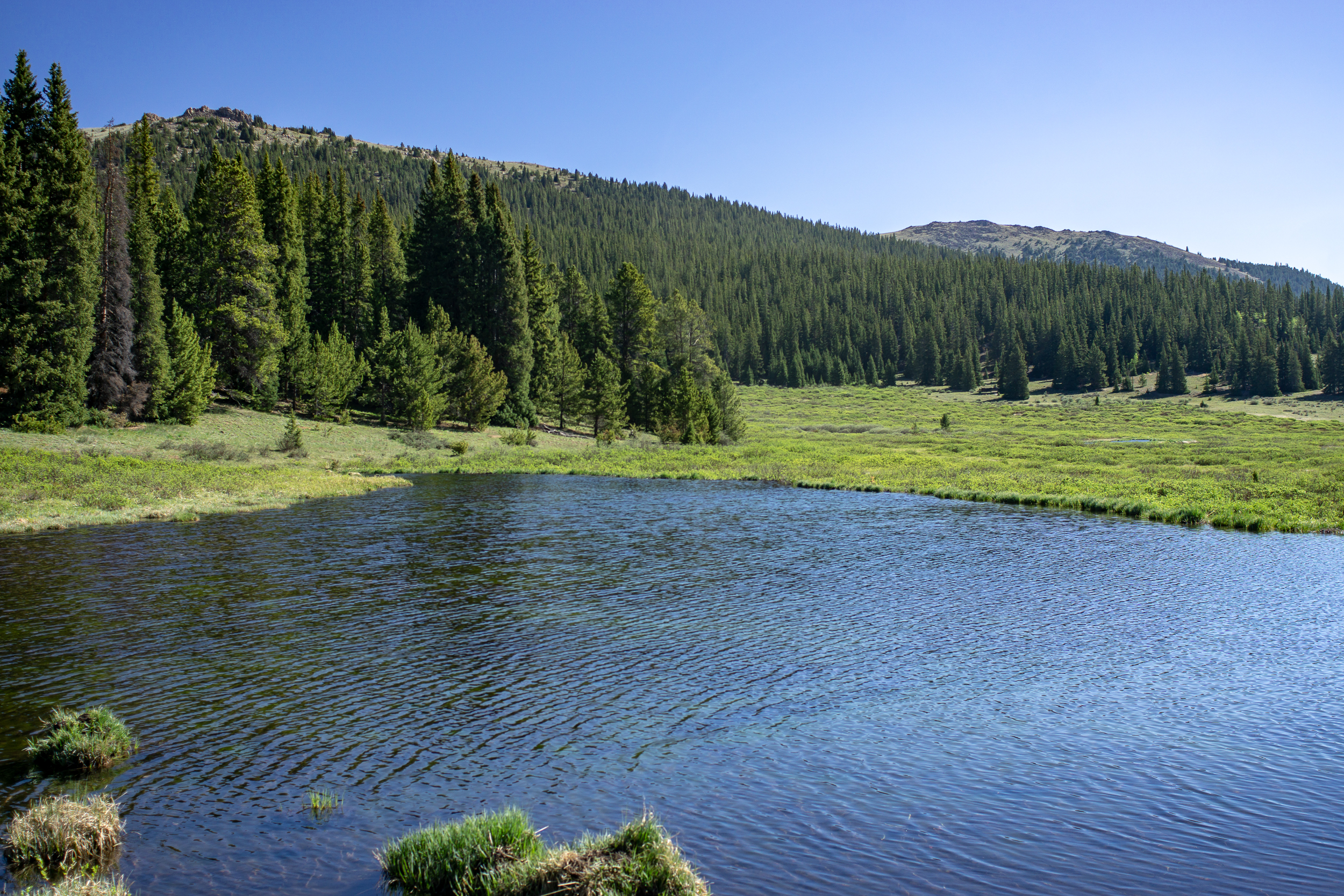
I’ve been to James Peak Wilderness before and I know there are multiple lakes with awesome campsites within 3-4 miles of the trailhead. This time I’m headed to the Crater Lake area, about 3 miles from the car. 

It’s late afternoon by this point and most people I pass are headed back to the trailhead. After 2 miles of steady gradual incline I get to the turn off to crater lakes. From here the trail becomes more steep before eventually flattening out near the lakes.

Unsurprisingly, there is a lot of activity around the lakes. On another weekend it could be a nice place to camp but for tonight I’m going another .5 mile and 400ft up to Upper Crater Lake. 

Blog Crater Lakes-0497.jpg
Blog Crater Lakes-0513.jpg

This is the steepest part of the climb and at lake level it becomes more of a rock hopping experience than actual trail. Not a lot in the way of flat sites but I find a little spot for my tent near the east side of the lake just past the outflow. The bonus is no one else is up here camping. 

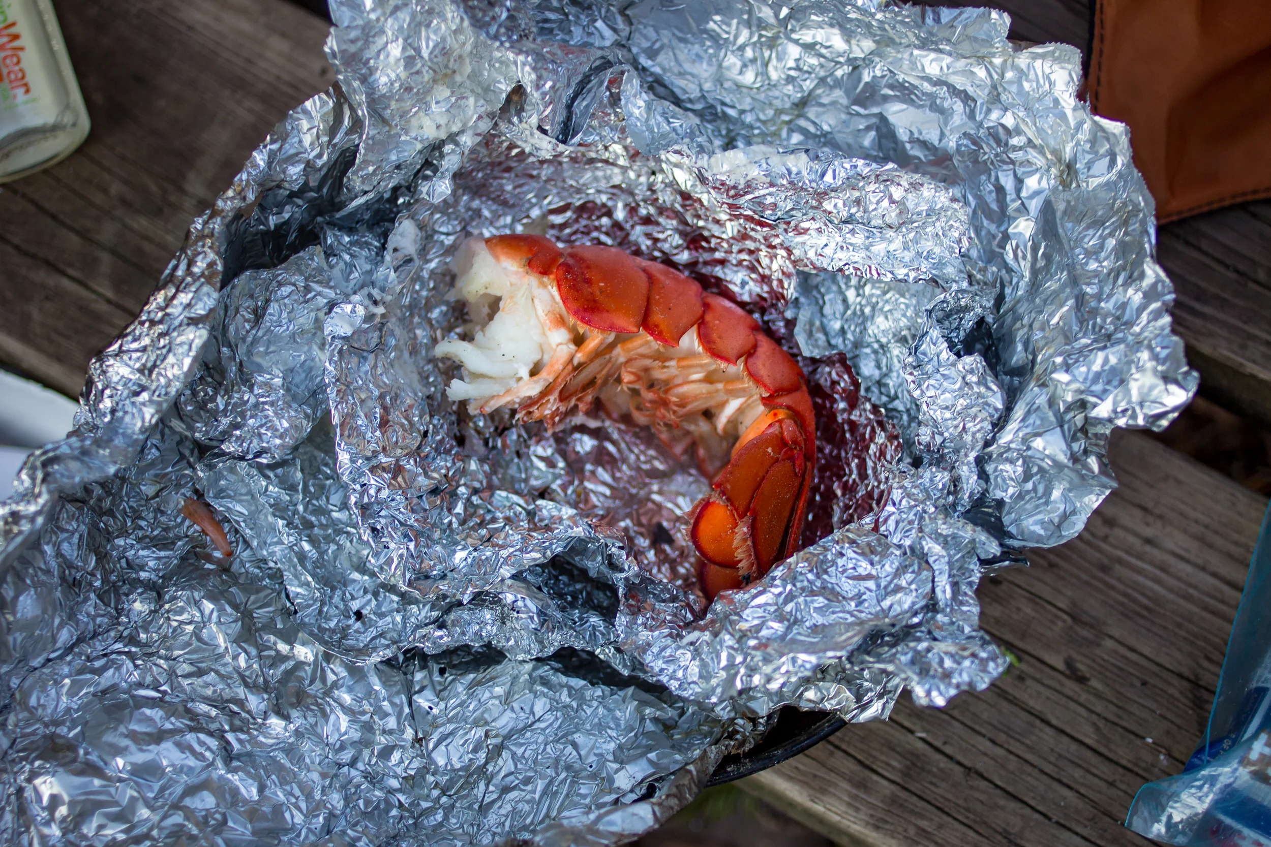
By the time I finish dinner it is already fairly dark and the Milky Way is starting to emerge. The job I was working this morning was using a Canon 5DS R with an 16-35mm zoom. Perfect for having a bit of fun messing around with long exposure shots while the sky is still moonless. This is a great camera, it’s completely impractical to bring into backcountry but, hey, what the hell.

Blog Crater Lakes-0469.jpg
Blog Crater Lakes-0460.jpg

The next day I make it out early to get home. From door to door the whole trip was only 20 hours but was a great reset.

If you go:

Buffalo Peaks Wilderness Backpack

I wouldn’t call this loop challenging by any stretch of the imagination and the views are nice but not going to top any “best of” lists for Colorado. But when the more scenic trails are still covered in snow and you’re looking for an easy, pleasant weekend trip it does the trick. You could easily do this route as a day hike too.

The loop is 11.5 miles total with a net elevation gain of ~2,000ft and no steep climbs. It’s located just south of Fairplay, CO. Access is an easy 2WD gravel road.

We did the loop counter-clockwise starting from the Rich Creek trailhead. The trail is a steady uphill for the first 5 miles (most of the elevation gain for the hike) through aspen, pine and then a meadow: the high point of the hike.

2018-Buffalo Peaks Wilderness-00328.jpg

Just after the high point we started looking for camping spots. As you go downhill a small creek starts to form. I suspect as the season goes on this creek dries up. We chose a spot not too far off the trail here amongst the trees about 50 yards from the creek. Turns out there is a more popular (and flat) camping spot about a mile down the trail just before the Tumble Creek trail junction, but the privacy we had was worth it.

2018-Buffalo Peaks Wilderness-00281.jpg

On day 2 we spent the part of the morning looking for the Buffalo Ridge 1470 trail but we couldn’t find the access; it may have been partially under water as the marshy area was full with spring snowmelt. Regardless the area was fun, we saw turtles, beavers and many birds in and around the water.

2018-Buffalo Peaks Wilderness-00302.jpg
2018-Buffalo Peaks Wilderness-00309.jpg

We followed the Tumble Creek trail for the rest of the loop back to the car getting nice views of east and west Buffalo peak along the way. I’d certainly recommend this loop if you’re looking to get away from the crowds and have a relaxing backpacking trip.  

If you go:

Rich Creek TH

Maps: Caltopo / Gaia

USFS Buffalo Peaks information

New Gear Testing

I did an easy two nights out to test a few new items I purchased to lighten my pack on solo trips. The first night was in a steep valley near a river approx 8,200 ft in elevation. Not normally an ideal place to camp given the cold air will sink to the valley floor, but I wanted to see how the gear performs in more humid conditions. Night 2 was above an alpine lake, approx 9,800 ft in elevation. Forecast was for lows near freezing on Night 1 and upper 30s on Night 2. Chance of rain was about 30% each night.

New gear tested:

-Enlightened Equipment Enigma 30F Short/Slim - $265

-Therm-a-Rest Z Lite Sol Sleeping Pad - REI $35

-Outdoor Research Helium II - $65, REI Garage Sale

Night 1

Night 1

Night 2

Night 2

Enlightened Equipment Enigma 30F Sleeping Quilt:

Those of you who know me know it’s pretty rare that I buy new items or drop serious coin on gear (patience is key to finding good deals). However, EE makes amazing gear and when I do buy new I like to support good folks. I love my 20F EE Accomplice for 2 person trips so it was a no brainer to go back to the well for my solo quilt. Night 1 was, as predicted, humid and just above freezing. With base layers and a hat on I was nice and toasty. Night 2 was in upper 30s and much less humid and I slept well without base layers.

For sizing I got the short/slim. The EE site says short is for “5’6” or under”, I’m 5’ 7 1/2” and I find the short to be the perfect size for me. My feet are snug in the footbox and the top of the quilt comes nicely to my chin. The slim size is for “50” or smaller”, I measure myself at 51”. I sleep in a corpse position and like to be essentially swaddled so this works great for me but it’s about the the smallest I’d go. If you’re the type of person who feels restricted in a mummy bag you’ll want a bigger size. The insulation value is in the loft, if the quilt is too tight around you it’s making the quilt less effective.

Fox friend at Lost Lake night 2

Fox friend at Lost Lake night 2

Therm-a-Rest Z Lite Sol Sleeping Pad:

Is it weird that over my many years of backpacking I’ve never used a closed cell foam pad? I’ve always had inflatable mattresses and only once over who knows how many nights have I had to deal with a leak. However, for $35 I figured it was worth a shot, especially since it weighs about the same as inflatables that cost $100 or more. While it’s not as comfortable as an inflatable I like a firm mattress and I slept pretty well. On a longer trip it’d probably get uncomfortable but for a week or less I think it’ll be fine. The best thing was the set up. Just throw it in the tent and you’re done. Amazing. Con was the bulk, I have to strap it to the outside of my pack, but for the cost savings I can deal.

Lost Lake in the morning

Lost Lake in the morning

Outdoor Research Helium II Raincoat:

This piece of gear makes its on to a lot of UL lists. I’ve been eyeing it for a while but at $150 retail you can about guarantee that I’m not going to buy it new. But when I saw one at an REI garage sale for $65 I figured it was time to go for it. On my scale the small weighs in at 5.7oz, a full 10.3oz lighter than my current raincoat (REI Crestrail). The 30% chance of rain never materialized so I didn’t get to put it through its paces but it did work nice as a windbreak layer in the evening.


Great Sand Dunes National Park

“Use the heater on the dash to warm up the turkey leftovers.” This is how our trip to Great Sand Dunes National Park started.

We had an unseasonably warm Thanksgiving weekend to get out and check out the dunes. The days are getting short, not much time left for hiking after a slow start and 4 hour drive from Boulder. Permits were easy to get, after talking with the ranger it seemed like we might be the only ones camping in the dunes tonight… Good sign? Bad sign? ¯\_(ツ)_/¯

BLOG-2017-12-02 GSDNP-09766.jpg

The basic backcountry instructions are to “go at least two ridges over from the visitor center, then camp wherever you want.” We took off from the parking area near the Medano Pass Road (which was closed) and hiked about 2 miles into the dunes before it started to get dark. The wind was intense but we managed to get the tent setup. I’m really glad we chose our heavier freestanding tent vs our Tarpent, which would have been near impossible to pitch in the dunes.

BLOG-2017-12-02 GSDNP-09665.jpg

Backpacking in the dunes is slow going, day 2 we made it a grand total of 5 miles. On top of the sand slowing us down we also were carrying all of our water for the day - there is no water in the dunes themselves and it was highly probable that we wouldn’t have water at the Aspen campsite either (there wasn’t).

BLOG-2017-12-02 GSDNP-09738.jpg

Early afternoon we exited the dunes and reached the Aspen campsite, aptly named as it is nestled in a grove of aspen trees with gorgeous views of the dunes and the mountains. It was much less windy here and with temps near 60 it was a great spot to lounge for the rest of the afternoon and enjoy the sunset.

BLOG-2017-12-02 GSDNP-1415.jpg
BLOG-2017-12-02 GSDNP-09815.jpg

We headed out early in the morning, using the last of our water to eat our breakfast and coffee. Little Medano Creek, our nearest water source, is about 1.75 miles from Aspen and we had a long break there refilling water and basking in the early morning sun. From here back to the car it’s about 5.5 miles and for the most part the sandy trail parallels the dunes. The last mile we chose walk on the 4WD road. The views were similar, just less sand.

BLOG-2017-12-02 GSDNP-09843.jpg

A Night in the James Peak Wilderness

It’s been a month since we’ve arrived, time to check out the backpacking around Boulder. Honestly, coming from Wisconsin I’m overwhelmed with choices on where to go. In the end we settled on James Peak Wilderness leaving from the East Portal/Moffat Tunnel trailhead. It’s 45 min drive from home, we get to camp at an alpine lake and walk on the continental divide. Sounds too good to be true. Turns out it isn’t.

Blog-2017-09 JamesPeak-0941.jpg

We arrived at the trailhead just before lunch and started walking the 4 miles to Rogers Pass Lake where we hoped to find a spot to camp. The aspens are already starting to turn and the first section of the walk through the forest was gorgeous.

Blog-2017-09 JamesPeak-09399.jpg
Blog-2017-09 JamesPeak-0944.jpg

To the lake it’s a steady incline, about 1,900ft, with plenty of places to rest and fill up with water on the way up. It took about 2 hours to get to the lake and we had many spots to choose from. After a bit of a rest we hiked up another .75 miles and 800ft to the the divide. On the way up we passed Heart Lake which was very windy with little cover. Glad we choose a spot at Rogers Lake. After Heart Lake it’s a steep push to the top.

At this point the ridge is very wide and you can walk miles in either direction. To the west there are great views of Winter Park and the mountains beyond and to the east there are views down the valley all the way to the front range.

Blog-2017-09 JamesPeak-0931.jpg
Blog-2017-09 JamesPeak-09460.jpg

After hanging out on the divide we headed back down to our camp. By then it was much busier by the lake, good thing we grabbed a spot when we did. It was a cool clear night and we had a great dinner of sausages and roast vegetables with some wine (hey it’s only a 4 mile hike in, might as well take advantage of it!).

If you go:

To the Coast!

Time for a major switch. It seems like we’re getting stuck with every turn. The Jasper debacle was a few days ago and section C of the GDT is still on fire, we aren’t going there anymore. Smoke is everywhere and it’s hard to see anything let alone hike in it, so we’re bugging out of the Canadian Rockies.

Jasper to Seattle isn’t really close but it is doable in a (long) day’s drive. We have lots of friends in Seattle and magically, in the middle of summer, they are all in town. Seattle is also close to the Olympic Peninsula, so for our last week-ish we will be spending part in Seattle and part exploring Olympic.

2017-07 Olympic-08941.jpg
2017-07 Olympic-08956.jpg

The weather in the Olympics is gorgeous. Sunny, warm and best of all no smoke! We end up spending most of our time on the coast (we’re moving to Colorado, the way we see it coast time will be precious, mountains less so). Backpacking on the coast poses some new challenges: dealing with tides, slippery rocks and sand. Cool!

2017-07 Olympic-08988.jpg
2017-07 Olympic-09038.jpg

From Rialto Beach we walk about 1.5 miles to just before the “hole in the wall” (a giant hole in the rocks) and manage to find a campsite directly overlooking two large sea stacks. We set up for the night on a surprising flat spot and build a fire (it feels so weird to have a fire after seeing all the fires in Canada). In the night we are awoken by rustling and a pair of little raccoon paws slowing dragging away one of our packs (we are following the rules, there is no food in there). We shoo it away. Minutes later the paws are back and we see the pack begin the slide away. Ok everything into the tent then.

The next day we decide that our spot is too good to give up (even with the raccoons) and we leave our gear set up and wander up the coast playing in tide pools and enjoying the beach. We make it back to our site for another beautiful sunset.

Maybe it was meant to be. The seed for this journey started with a book on the Pacific Northwest Trail and here we are sitting on a beach, spending our last few days backpacking on the PNT itself.

2017-07 Olympic-09073.jpg

A Short Jaunt on the Lake Superior Trail

Getting into the woods with my uncle hardly ever means roughing it. Don’t get me wrong, we did hike 5 miles in to a spot of Lake Superior, so we did something. And considering the circumstances, I’ve been looking forward to this trip for a while.

 
Porcupine Mts April16-2378.jpg
 

My Pictured Rocks backpacking trip last November wasn’t supposed to be a solo trip, but my uncle needed emergency heart surgery (he’s fine now, he’s obviously on this trip). After the surgery he made me promise that we’d do a “consolation trip” as soon as he healed.

It’s been six months but I’m not sure spending 3 days backpacking in temps of lower 40s by day and mid 20s by night (not to mention the wind chill never really getting above freezing) is really doctor approved. But for a guy who was bedridden all of cross country ski season I don’t think no was an option.

So back to roughing it… Food is always central to any trip with my uncle. Night 1 was his meal to cook.

Porcupine Mts April16-2363.jpg

Makes my night #2 fire-cooked tacos look downright pedestrian.

The trip itself was fairly mellow. Walk in to camp on the Lake Superior Trail from the Pinkerton trailhead on day 1, go for a day hike up the Carp River on day 2 and walk out day 3.

The weather up the Carp River Trail was actually very pleasant, near 60 and not windy. Probably would have made the most sense to camp there but there is a certain draw to being near Lake Superior that I can’t shake. The sun was out in the afternoon and even with the wind chill it was nice to look out over the lake, or as my uncle put it “it’s fairly pleasant in the sun, with five layers on.”

I’m not entirely sure what the story is with this, but it makes an appearance at every camp my uncle makes.

Porcupine Mts April16-2316.jpg

Blue Mounds Bike Camping

One of the nice things about living in Madison is bike camping. Our house is 2 blocks off the Capital City Trail which leads out of town in multiple directions, many of which have bike-up camp sites starting 20-30 miles out of town. It’s especially nice when on Friday you see a good weather window and you can decide on the spot to head out for a night.


We chose to go west on the Military Ridge Trail and camp at Blue Mounds State Park, which is just over 30 miles from us. You could certainly choose to glamp it up on the way out (as we did) and stop at many places. We grabbed dinner at the Grumpy Troll Brewery and Pub, about 6 miles before the campground. Nothing like a good pizza and a couple beers after biking.

BLOG 2016-04-15 Bike Tour-4662.jpg
BLOG 2016-04-15 Bike Tour-4663.jpg

On the way home we stopped at the Tuvalu Coffee House, a little more than halfway home, for coffee and some baked goods. Made it back in the afternoon with plenty of time to chill and enjoy the rest of the afternoon sun on the porch. My kind of weekend.

If you go:

New Years in the Porkies

Back to the Porcupine Mountains. Crazy how much difference a month can make. Full winter mode now and today it’s a walk in snowshoes back to the Union River Hut. Not quite enough snow for grooming but more is forecast for tonight so fingers crossed for some good skiing.

Blog 2016-01 NYE Porkies-4117.jpg
Blog 2016-01 NYE Porkies-4108.jpg

Day 2 brings in more snow (yay!) and also the rest of our group for a New Years celebration. Groomers were out rolling (but not tracking) the trails so we have some skiing. Let it be known that the woodstove in the Union River Hut is either on full steam ahead or off. Someone from our group got a little overzealous loading the stove with wood before bed and I woke up in a sauna.

New Years Day the sun was out and we had really nice conditions for skiing. Hardly any activity on the trails besides us and plenty of new snow to ski through. We spent most of the day exploring and enjoying the trails. The West Vista lookout is a tough climb but well worth the views (my phone battery died so no pics).

Blog 2016-01 NYE Porkies-0653.jpg

The last night it was just 4 of us in the hut. Matt and I decided to do one last sunset ski up to the East Vista Overlook. After the sunset we started making our decent back down and stopped outside a warming shelter to get our headlamps out. While we were digging in our packs the door of the warming shelter opened a crack and a man called out “I’ve got a nice fire going in here...” (me: skeptical/possibly creeped out) “...also if you want to help me finish this 6 pack of Hopslam….” Matt turns to me, raises his eyebrow and bolts into the hut. I follow. After a good hour of “helping” our new friend and enjoying the cozy cabin we ski out by moonlight to our hut.

If you go:

Speakers Cabin - Porcupine Mountains State Park

[Read about my 2021 trip to Speakers Cabin here]

The hike into Speakers Cabin is hardly constitutes a hike (it’s about a mile), but the cabin has arguably the best view of Lake Superior of all the cabins in the Porcupine Mts. It also sits on the Lake Superior Trail making for nice day walks in either direction.

SpeakersCabin-0989.jpg
SpeakersCabin-0987.jpg

About a foot of snow fall near Summit Peak a few days before had us daydreaming about some snowshoeing, but other than the drive from ranger station to the Speakers Trailhead there was no snow at lake level. (We did learn that our little 2WD RAV4 can power through the snow surprisingly well, yay!)

Arriving at the cabin in late afternoon we cranked up the woodburning stove and got it nice and toasty. Then, glancing through the log book, we noticed multiple warnings to NOT get it too hot. Why? If it gets too toasty hundreds of flies resurrect and delight in the warmth… It was already too late, the buzzing had begun. We spent the rest of the weekend trying to find the sweet spot of keeping warm but not so warm that the flies would come back to life.


After the fly drama we settled into a relaxing night looking at the many guidebooks left in the cabin and a few board games we packed in (the luxuries of a one mile hike).

On day two we did the short 2-ish mile hike to the Presque Isle scenic area. It was fairly flat and had a decent amount of water on the trail, likely from the storm that dumped the snow higher up. The hemlock trees lended a spooky ambiance on an overcast day.

SpeakersCabin-1018.jpg

Had lunch at the falls, ambled back to the cabin and were treated to a gorgeous sunset before heading back in to a warm (but not too warm) cabin. The next morning we headed back to the car and back home.